Tag Archives: Riquewihr

Wine on the Way


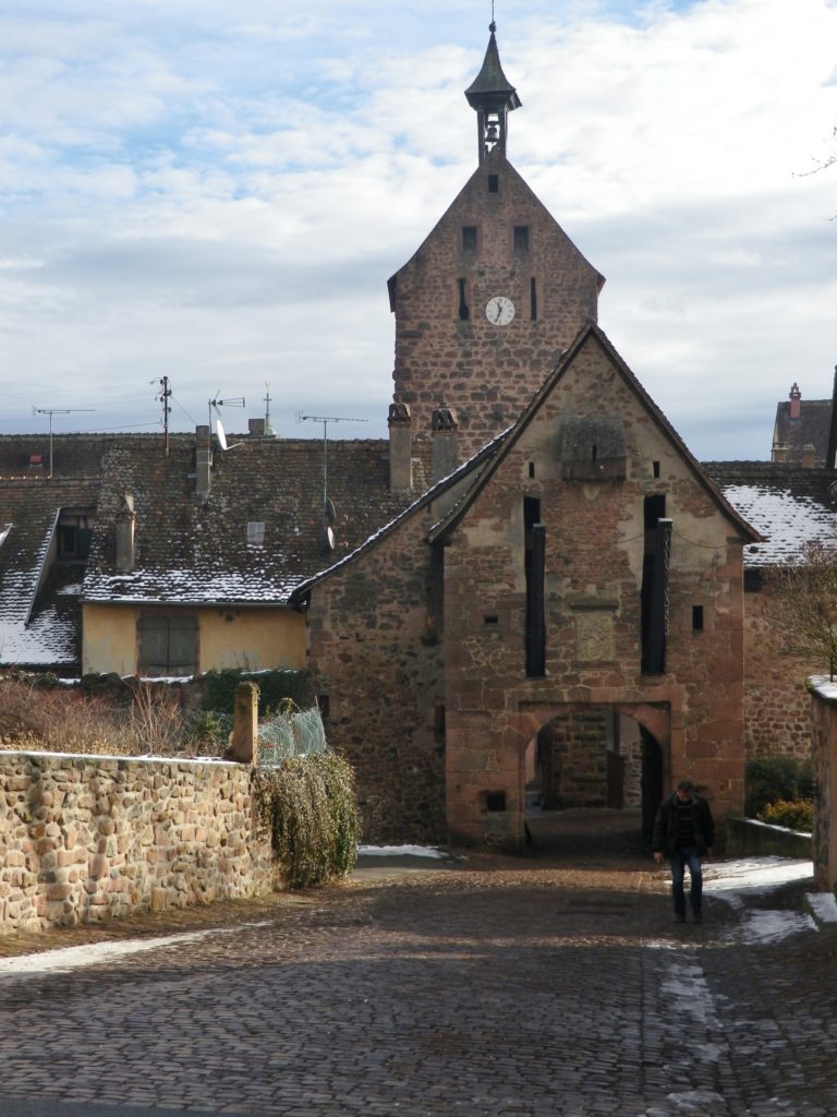
Wine is a great European tradition. The Way of Saint James (“The Way”), a pilgrimage route to the far northwestern corner of Spain, is another. The two combine magnificently on this short hike.

Around the year 1000 A.D., people across northern Europe began to undertake pilgrimages to the shrine of Saint James (the Greater). The routes they took to northern Spain tended to converge in France, just in front of the Pyrenees, which they would cross in groups, before continuing the long trek across northern Spain. Of course, for northern Europeans, there was no one route, rather a series of waypoints (mostly small towns or large monasteries) that lead to the Pyrenees’ passes. Most of these waypoints were a day or so apart, where those who hiked The Way (and that was most of them), could find food, shelter and safety for the night. The routes today, if not strictly identical to the ones in medieval times, still follow that precept.  Hiking in Germany, northern France, even Switzerland, The Way routes are seemingly ubiquitous. It is now popular to hike in stages over the years, culminating finally at Santiago de Compostela.

Riquewihr: Porte Haute

Continue reading Wine on the Way

Wine Notes: Alsace Haut-Rhin Grands Crus


What I Learned

Alsace’s Haut-Rhin (upper Rhine) area’s interesting geological history resulted in some great terroirs.  It was initially born of volcanic activity. Once spent, the volcanic mountains collapsed on themselves, and an ancient sea covered the area. Then two roughly parallel mountain chains arose (the Vosges in France, and the Black Forest range in Germany), and the ancient Rhine river poured through the resulting valley. As the river receded to its current banks, it exposed the slopes of the Vosges. The soil here is incredibly complex, thanks to this geological history, and it results in minerally, and complex wines.

Continue reading Wine Notes: Alsace Haut-Rhin Grands Crus

Alsatian Way of St. James: Trail in a Nutshell


Trail Name: The Way of Saint James (Chemin de Saint Jacques de Compostelle)

Trail Type: Long distance; much of it paved (in this section), well maintained, and fairly well marked.

Length:

Total –  Approximately 2000 kilometers (to reach Santiago de Compostela, Spain, from northern Alsace)

Segment – 7.5 kilometers/ @4.5 miles

Convenient to: Colmar, Alsace, France

Marking:

“Chemin de Saint Jacques de Compostelle” (Stylized cockleshell of yellow rays on a blue background)

Signage for the Way of Saint James

Continue reading Alsatian Way of St. James: Trail in a Nutshell