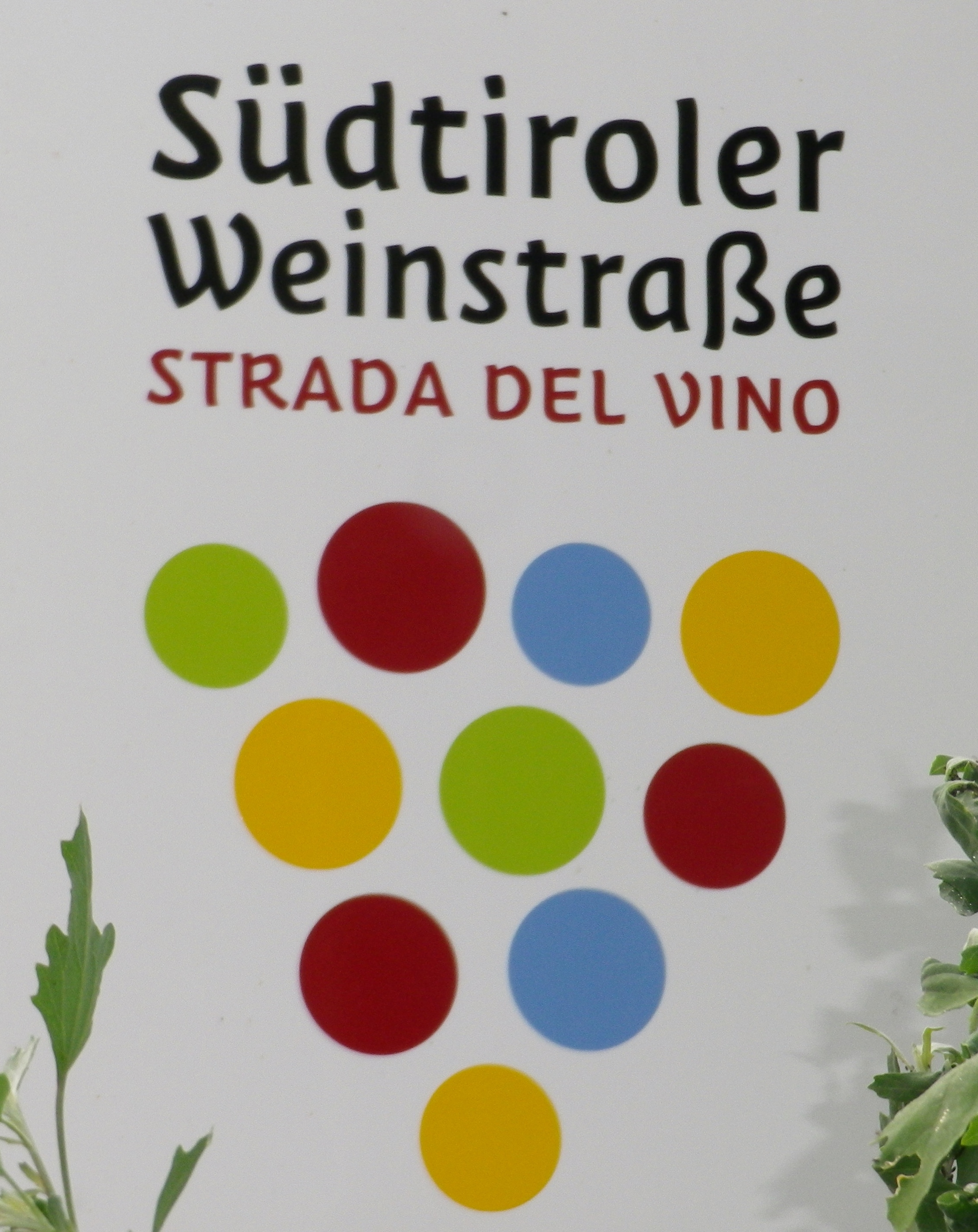
Trail Name: Trail of Lagrein and Sauvignon/Weinroute Nord (Northern Wine Route) of the Suedtirol Weinstrasse.
Trail Type: Mid-distance cycling circuit; almost exclusively paved, well maintained, but the route itself is not marked.
Length: Total: 45 km/28 miles
Convenient to: Bozen/Bolzano, Suedtirol/Alto Adige, Italy
Marking: No Northern Wine Route specific markings observed. See the generic Suedtiroler Weinstrasse marking below.
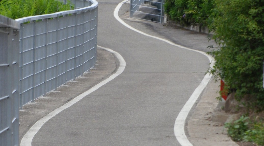
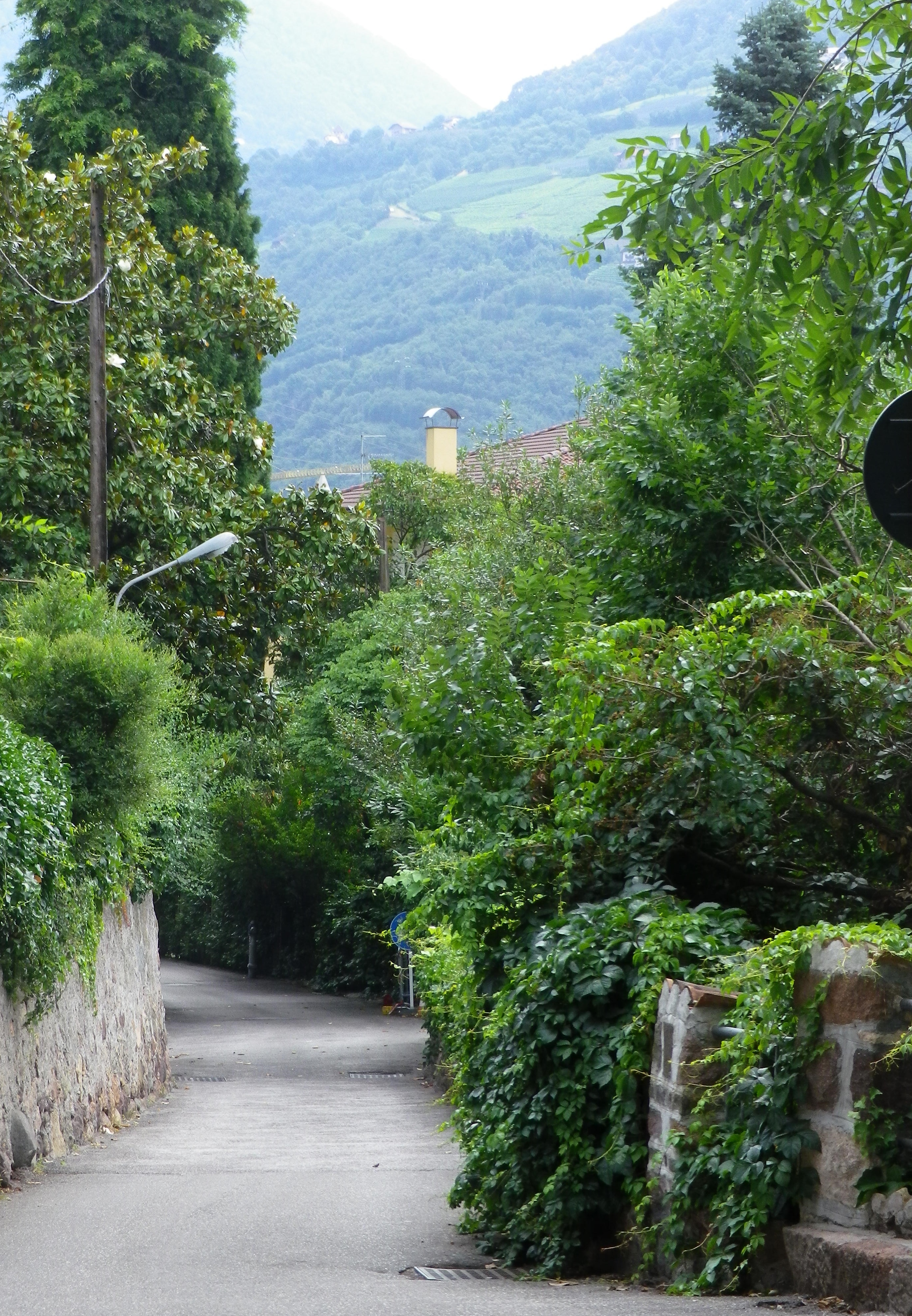
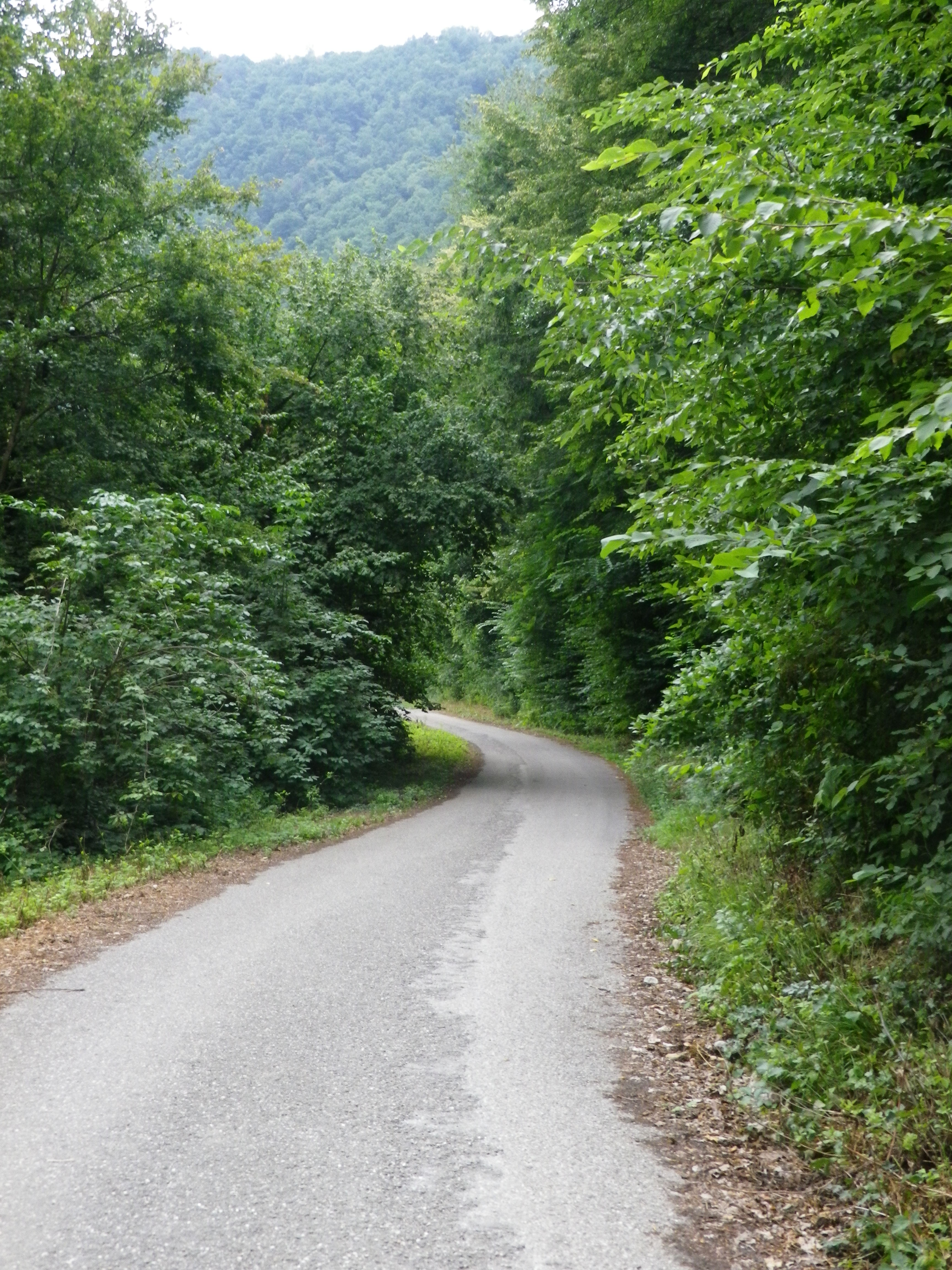
Trail Description: The route passes through Bozen and surrounding wines villages, following river valleys along what is known as the Suedtirol Weinstrasse , or Strada del Vino, in Italian: the South Tirol Wine Route. About 50 percent of the route is on dedicated bike path, although some stretches in and between villages, do proceed on slightly trafficked roads. This bike ride has some ascents and descents, but is mostly flat, following river valleys in the heart of the Dolomites. The awe-inspiring alpine scenery, set in such lush valley surroundings, makes this a bike ride to remember.
Trailhead:
Bozen (Bolzano, in Italian): Waltherplatz
Alternates:
-Terlan: Karl Atz Platz or
-Andrian: Via del Sole – Wolfsthurnstrasse
Parking Possibilities:
Bozen: Underground garage near Waltherplatz (not free)
Andrian: a small area for about 15 vehicles on Via del Sole-Wolfsthurnstrasse
Terlan: a mid-sized lot off Karl Atz Platz by Jakobistrasse
Public Transportation Options:
Bus: Line 201, Verkehrsverbund Suedtirol, runs from Bozen to Meran with stops in Terlan and Vilpian, during morning and afternoon/evening hours. Check for this and other line hours at https://www.sii.bz.it/de/verkehrsverbund-suedtirol
Rail: Bozen, a main station from the south (Verona) to Austria (Innsbruck). Regional trains service Terlan and Vilpian (on the route), continuing to Meran. See trenitalia link for more info.
Suggested Stages: Not applicable
Trail Itinerary-Reference Points:
Bozen: Waltherplatz-Piazza Giuseppe Verdi; Kardaun: Eggentaler Bach bridge, Rentscherstr; Rentsch: Brenner-Via Sant’Oswaldo, Parco Petrarca – along the Talfer River; Gries: Fagenstr-Via Vittorio Veneto-Via San Maurizio; St Moritzing: Meranerstr; Siebeneich (Settequerce, in Italian); Klaus (Chiusa, in Italian); Terlan: Karl Atz-Hauptstr; Vilpian: Meranerstr-Nalserstr, over the Etsch (Adige, in Italian) River; Nals: Andreas Hofer-Andrianerstr: Andrian: Wehrburg-Wolfsthurn-Eppan; Riva di Sotto; Frangart: Pillhof-Boznerstr, toward Castel Firmian, over the Etsch River and follow the bike trail to Rechtes Eisackufer (Via Lungo Isarco Destro, in Italian), follow signs to Druso Stadium and then Bozen center on Leonardo Da Vinci to start/end point Waltherplatz.
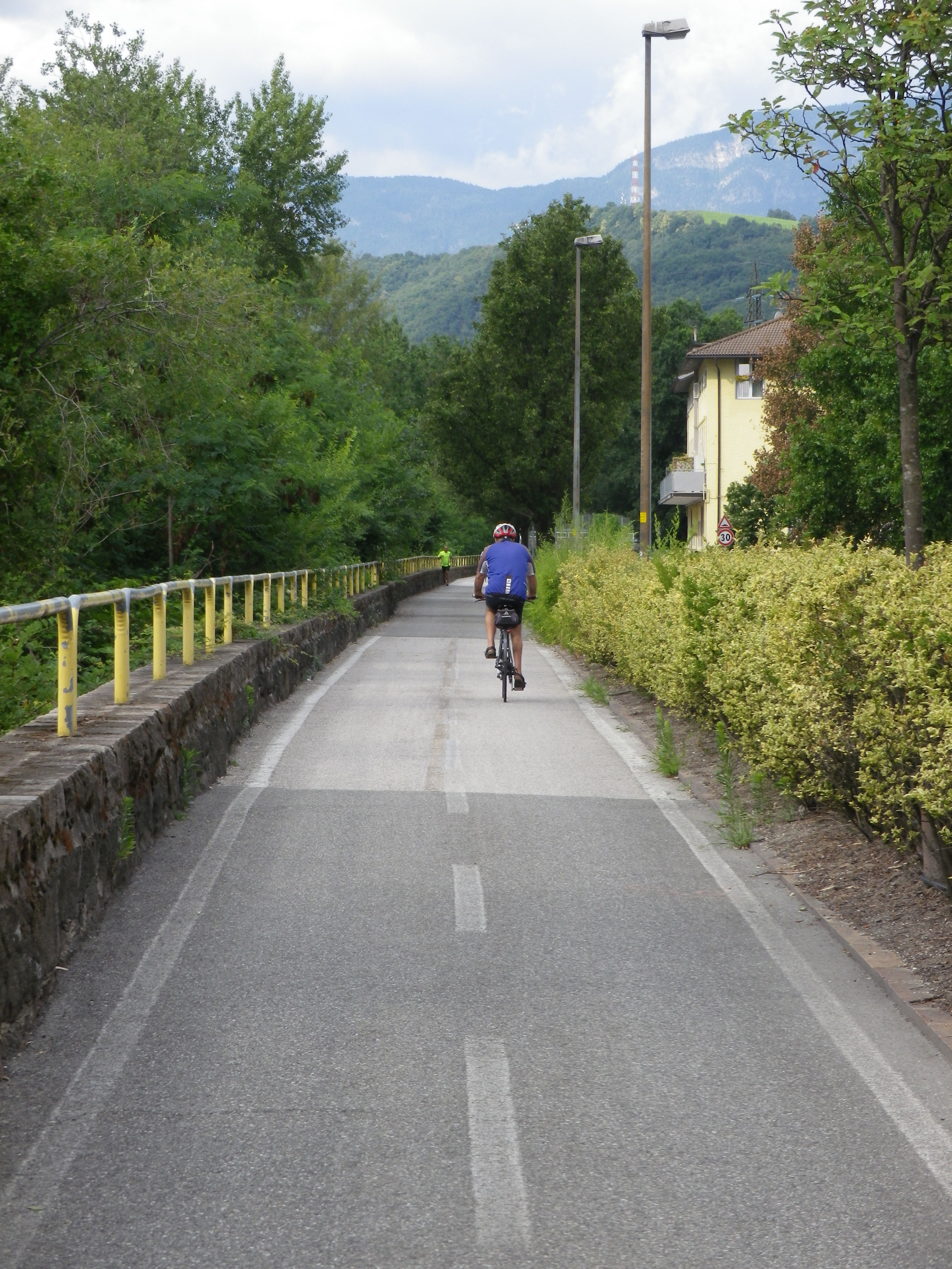
Representative Trail Photos:
Restrooms:
Bozen: Train Station, Bahnhofsallee/Viale della Stazione
Andrian: Tourist office, just off Via del Sole (Open only during business hours.)
Attractions on or near Trail:
Bozen:
Archeological Museum, exhibiting Oetzi, a man preserved in ice for 5000 years, and what scientists know about him and his environment.
Museums for city, mercantile and natural history
Churches, such as the Cathedral, the Dominican, Franciscan and St John’s
Runkelstein Castle, with well-preserved frescos decorating its rooms
Gries:
Muri-Gries Abbey – art, wine and history
Herzogspark/Parco Ducale
Frangart:
Messner Mountain Museum in Firmian Castle
Tasting along the Trail:
Kellerei Bozen (Bozen), Muri-Gries Abbey (Gries), Von Braunbach (Siebeneich), Kellerei Terlan (Terlan), Kellerei Nals Margreid, Kellerei Andrian (Andrian), as well as many smaller wineries; and plenty of wine bars and pubs along the way
Alternative Options:
Biking: For a shorter ride: Travel by rail or bus to Terlan or Vilpian, and bike the route from there. Alternatively, use the bike path along the Etsch to return to Bozen from Vilpian or Nals.
Car: Suedtiroler Weinstrasse (Strada del Vino Alto Adige, in Italian) follows much of this route and more. (See marking above.)
Additional Information:
Regional: http://www.suedtiroler-weinstrasse.it/ http://www.bolzano-bozen.it/en/bolzano.htm
Trail (segment) specific: http://www.suedtiroler-weinstrasse.it/deutsch/wein-amp-rad/weinroute-nord.html
Comments:
Use the link above to download the GPS coordinates. The route itself is not marked, although general signage points the way to the main towns and villages on this route.
In this area, both Italian and German names are used. While fairly intuitive, I also include the Italian versions where not so obvious.