Trail Name: Sentier des Vignobles a Chavanay
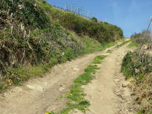
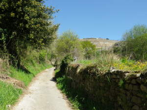
Trail Type: Medium distance circuit; partly paved, some hard-packed path, some sandy and rocky stretches, fairly well maintained, and fairly well-marked albeit not with the trail name as stated above.
Length: 12 kilometers/circa 8 miles
Convenient to: Vienne, France
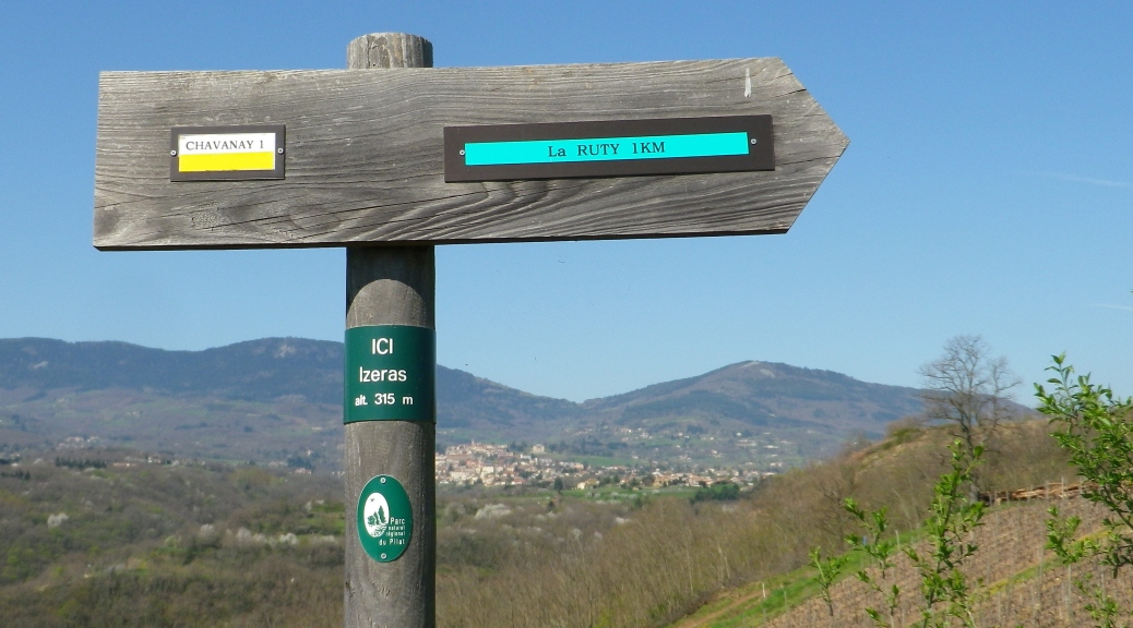
Marking:
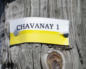
White and yellow rectangular stripes, sometimes painted or sometimes on a board, sometimes with the words “Chavanay 1”, (vice Sentier des Vignobles a Chavanay). Also see the typical trail signpost, above.
Trail Description: This circuit is a good introduction to the northern part of the Saint Joseph wine appellation. While it starts in a village, close to the Rhone River, its rapid ascent into the hills above the town is rewarded by magnificent views of the river in front of the village and mountains behind it. The feeling of rural France is enhanced as the trail continues atop the ridge, and into the village of Verlieu. As the trail turns to return to the trailhead, there are opportunities to rest and picnic along the Rhone canal.
Trailhead:
-Official: Chavanay – Rue des Remparts
-Mine: Avenue du Rhone, near the intersection with Route de l’Ancien Pont
Parking Possibilities:
Chavanay:
-Parking De la Tour, a lot by the intersection of Rue du Chirat and Grande Rue. (Look for a tower in the town wall.)
-Small lots near the train station (Gare) off D1086
-Several spots along Avenue du Rhone, near the intersection with Route de l’Ancien Pont (Look for tall old bridge supports)
Verlieu: several dedicated spots along Chemin Neuf Verlieu
Public Transportation Options:
Bus: TIL (Transports Interurbains de la Loire) 131, or 128, Vienne-Pelussin; at stops: Verlieu, Luzin or Place de la Halle
Rail: No service in this area
Suggested Stages: Not applicable
Trail Itinerary-Reference Points: (clockwise)
Chavanay – Parking De la Tour: Rue du Chirat x Grande Rue-Rue des Remparts-Rue du Faubourg, cross D90 into vineyards, follow twists along a concrete path, then just below a small settlement, turn left/southwest along a path to la Madone statue on a plinth; Follow along unimproved road then a path to La Ruty/Izeras, follow along a tree-lined path continuing toward La Ruty; there turn right into A La Ferme campgrounds going toward then along a treeline, follow the signs for Le Rat/Chantelouve, turn left on road toward Chantelouve, over a stream (La Chanson), and first right at Chantelouve; head toward la Voturerie, going through copses and meadows; at la Voturerie, once on D90, turn right, shortly thereafter turn left toward Domain du Monteillet in the village of Montelier; in the village, go left (north) heading through mostly meadows toward and through Meve; head through vineyards downhill to Verlieu; Verlieu: Route Royale-Route Royale Calvaire, turn right to follow alongside church, cross RN 86/D1066 heading to Chemin Neuf Verlieu; head toward Chavanay, then along Avenue du Rhone, pass picnic area and two free-standing old suspension bridge support plinths, continue to, over, then back over, the Valencize stream; cross under D1086 and follow the stream back to the De la Tour parking area.
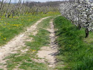
Representative Trail Photos:
Restrooms:
Chavanay: Avenue du Rhone, by the parking and picnic area; two others in Chavanay (in the park near the De la Tour parking, along the path; and by the train station) appeared to be permanently disabled.
Attractions on or near Trail:
Tasting along the Trail (Hours for visits and tastings can be limited, or upon reservation only!):
Verlieu: (near D1086 x Chemin Neuf Verlieu): Cave Yves Cuilleron, and further down the road, Vins de Vienne.
Chavanay/La Madone: Domaine Chante-Perdrix
Chavanay/Montelier: Domaine du Monteillet
If these are closed, take heart: Local eateries serve local wines, and the Leclerc supermarket in Verlieu on D1086 carries local vintners’ products.
Alternative Options:
Running: Except for the downhill section into Verlieu, this entire trail is suitable for running
Biking:
-VTT 11: a local trail for mountain bikes followed this circuit in part, and additional territory
-Via Rhona: the river section of this hiking circuit, and further territory north and south of Chavanay, is traversed by this long distance biking trail along the river, but not in the vineyards. In the Sablons-Chavanay-Condrieu section it follows along a dedicated bike path, making it ideal for families with children.
Car: Routes des Vins des Cotes du Rhone, the Route du Septentrion, also known as Vignobles Septentrionaux, covers this area and more.
Additional Information:
Regional: http://www.vins-rhone.com/fr/route/vignobles-septentrionaux
Trail (segment) specific: http://www.pilat-tourisme.fr/fr/mon-parc-randonnees/83-mon-parc-randonnees/circuits-telechargeables4/576-randonnees-journee.html
Comments:
Parking, then beginning the hike by the old bridge supports on Avenue du Rhone is a good option for ease of parking, a longer warm-up before reaching the steep slope up, and a functioning restroom. Additionally, with nearby tables, benches and a covered pavilion, it is a great spot for a picnic along the river at the end of the hike.
Some hikers will find this trail too warm and sunny during the summer months.