Trail Name: Circuit de Saint-Marc
Trail Type: Mid-distance hiking circuit; partly paved, part dirt; no specific marking for this trail.
Length: total: 11 km/6.8 miles
Convenient to: Epernay, France
Marking: Varies by section of the circuit.
Hautvillers to Romery: yellow rectangles painted on surfaces
Through the woods outside Romery: sometimes yellow rectangles, sometimes circles (the faded color looked red/pink/orange) painted on surfaces
Returning to Hautvillers: red over white rectangles
Hautvillers: Rue du Dessous des Clos and D386
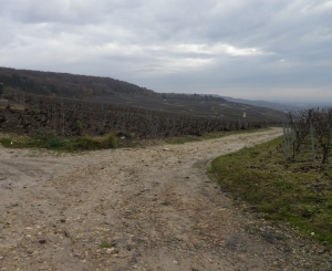
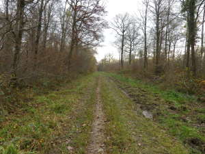
Trail Description: This circuit trail, just outside Epernay in the famous village of Hautvillers, is of medium difficulty, both to hike and to follow. It wanders over and around the Mountain of Reims (Montagne de Reims), and affords great views of vineyards as far as the eye can see. Much of the trail passes through or along vineyards, as well as through woods, and to a lesser extent than the preceding two landscapes, through the villages of Hautvillers, and a tiny corner of Romery.
Trailhead: Hautvillers, Rue Domaine Perignon or Rue de l’Aubrois.
Parking Possibilities:
Hautvillers: medium-sized lot at intersection of D386/Rue des Cotes de Lhery x Rue du Dessous des Clos; spots near the picnic area and soccer field at the lower end of Rue de l’Aubrois.
Romery: Spots on the trail in the vicinity of the picnic area along D322.
Public Transportation Options: None observed/Not applicable along the trail.
Suggested Stages: Not applicable
Trail Itinerary-Reference Points:
Hautvillers: Tourist Office, Rue Domaine Perignon-Ruelle Gome-Ruelle Quatre Freres-Rue de Fismes, left at Champagne Dagonet & Fils, along an ascending path; Forest road (Chene La Ramee) (straight line for about 2 kilometers); Romery: D322/Route d’Hautvillers (into and through Romery), turn left onto trail at picnic area, follow sign for Boucle de la Foret Hautvillers; Forest with occasional solid white, and red/pink/orange (?) circles painted on trees, at barrier gate where the vines begin, go left. Vineyards, eventually (about one kilometer later) join and follow marking for Grande Randonnee 14 (red over white rectangles), a crucifix in the vineyards above Cumieres; Hautvillers: soccer field, a shaded picnic area, lower end of Rue de l’Aubrois, Rue de Cumieres-Rue Henri Martin (to return to the tourist office).
Representative Trail Photo:
Restrooms: None Observed
Attractions on or near Trail:
Hautvillers: Monastery Church of Hautvillers, with tomb of Dom Perignon; Premier Cru vineyards.
Tasting along the Trail:
In Hautvillers, there are about a dozen champagne houses open to the public for tasting, but most require reservations. Not all of these offer cellar visits. Contact the Tourist Office (link below) for up to date advice and assistance for any visit.
Au 36, Rue Domaine Perignon, Hautvillers: a shop for tasting and purchases.
Alternative Options:
Hiking: Also just outside Epernay, the Boucle de Chouilly, is a 14.7 kilometer hike through Grand Cru territory, with a shortened circuit incorporated within it covering only 7 kilometers.
Car: The Route Touristique du Champagne trail, the section covering Epernay-Champillon-Cormoyeux-Romery-Hautvillers-Cumieres, visits the areas on or near this trail, and more.
Additional Information:
Regional: http://www.ot-epernay.fr/
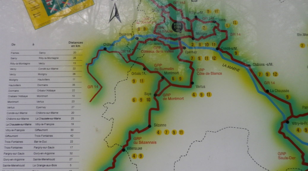
Trail (circuit) specific: http://www.tourisme-en-champagne.nl/en/224/15/7/ITICHA051FS0002P/sit/detail/randonnees/circuit-de-saint-marc/reloadform/1 (click on “download” button for map). Click here for gpx points: http://www.gps-route.org/showRoute.php?route=233
Comments:
Strongly suggest using a navigator for this trail. Markings on the route vary and are sometimes ambiguous or missing at crucial intersections. (See the trail links above)
Strongly suggest wearing boots.
During late November, a kilometer-long section of the trail through the woods outside Romery was a morass of mud up to a foot deep in places. By contrast, the trail through the woods outside Hautvillers was muddy, but walkable.