Trail Name: Rieslingweg
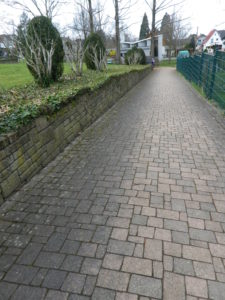
Trail Type: Short distance circuit trail; well-maintained and almost exclusively paved, very good marking on the trail
Length:
Total – 7.1 kilometers/4.4 miles
Convenient to: Baden-Baden, Germany
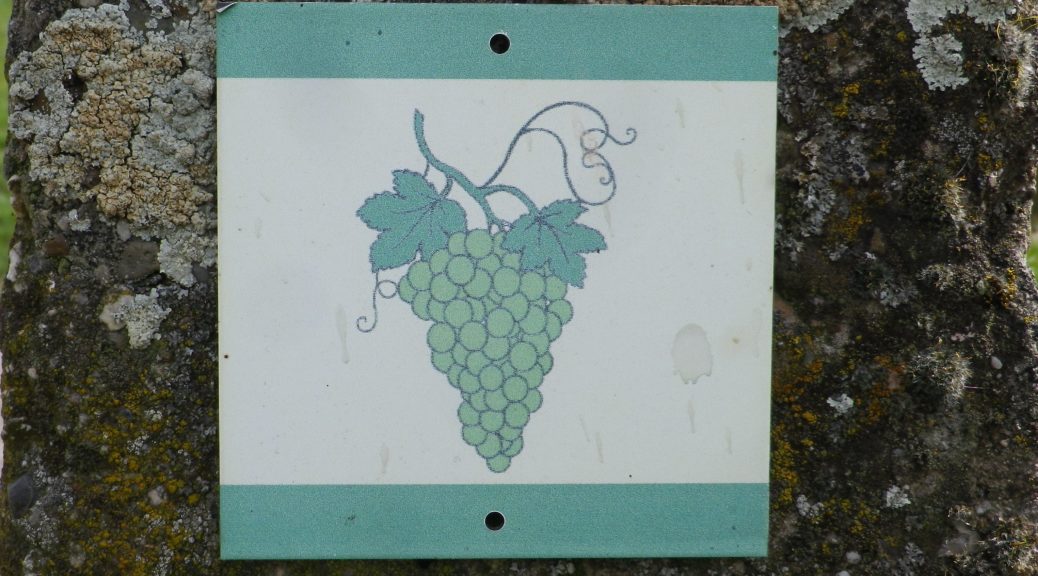
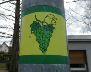
Marking: Green grapes with a green leaf on a white (sometimes yellow) background
Trail Description: A trail through the village and vineyards of Eisental-Buehl. It would be an easy, family friendly trail as it has only very moderate inclines, an almost exclusively smooth surface, and its configuration lends it to shortening it easily, if needs must. However, be aware that there is virtually no shade along this trail. On the other hand, that makes it ideal for a cold winter day!
Trailhead:
Official: Eisental-Buehl, Affentaler Winzer, at L84 x Immensteinstr
Mine: Eisental-Buehl, Winzerstrasse x Weinstrasse (See comment)
Parking:
Wanderparkplatz Horrenbachbrunnen, Weinstrasse, on town outskirts, about 300 meters after Betschgrabenstrasse (In which case, join the trail at Weinbergstrasse x Weinstrasse.)
Public Transportation Options:
Rail: Light rail train services Buehl area with stops at Rebland and Buehl. Both stations are about 3 kilometers from the trailhead, as the crow flies.
Suggested Stages: Not applicable
Trail Itinerary-Reference Points: (Counterclockwise)
Eisental-Buehl: North on Immensteinstrasse, cross Weinstrasse into vineyards, cross the intersection of Im Koebling and Sonnenbergstrasse, follow to Horrenbacherstrasse, Weinbergstrasse, Schartenbergstrasse, Weinstrasse, path along the cemetery, Friedenstrasse, Kirchbachstrasse, Tillmetten, Inselstr, Weinstrasse, Winterberg, Schelmanngasse, to Carl Netter Turm (Look-out tower), Immensteinstrasse.
Representative Trail Photo:
Restrooms:
None observed
Attractions on or near Trail:
Just lots of vineyard and mountain scenery
Tasting along the Trail:
Affentaler Winzer, a cooperative winery, on L84, at the entrance to Affental, as well as a couple of independent wineries in town.
Alternative Options:
Hiking: The Ortenauer Weinpfad, an extremely scenic 100-kilometer trail from Gernsbach to Diersburg, between the Black Forest and the wine villages in the foothills. See here for further information on the trail in this area.
Car: Badische Weinstrasse, a 200 kilometer/124-mile car route for wine enthusiasts, begins in Baden-Baden and ends at Weil Am Rhein (on the Swiss border). It roughly follows Highway 3 from north to south.
Additional Information:
Regional: https://www.buehl-buehlertal-ottersweier.de/
Trail specific: https://www.bergfex.de/sommer/baden-wuerttemberg/touren/themenweg/57360,rieslingweg-in-buehl-eisental/
Comments:
Affentaler Winzer is the official start for this trail, however parking is problematic there, as it is for winery customers, and delivery trucks use the side lot. For an alternative start point with parking, see the Parking note above.
If hiking this trail with in conjunction with the Rotweinpfad, described here, the two trails intersect at Eisental-Buehl, Winzerstrasse x Weinstrasse, (near Pfarrkirche St Matthaeus), or the parking lot “Wanderparkplatz Horrenbachbrunnen” on Weinstrasse, both of which make good start points.