Trail Name: Rheinterrassen route
Trail Type: Long distance; almost exclusively paved, well maintained, but the route itself is not marked.
Length: total: 50.5 km/31.5 miles
Convenient to: Mainz or Worms, Germany
Marking: Dark green and lighter green lines, and silhouetted town skyline, on a white background.
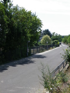
Trail Description: An easy, completely flat route, entirely on asphalted or hard-packed surfaces through the Rhein Terrasse wine district. This low-key trail alternates between the small towns and the vineyards on their outskirts. It provides cyclists an intimate look at this area as they pedal among vines, or along mostly quiet streets in the small towns.
Trailhead(s):
Worms: Stadtpark (Friedrichsweg)
Mainz-Laubenheim: Dammweg
Parking Possibilities:
Note: Worms inner city has many pay parking garages. The many parking lots/spots are also pay, but most have time limits.
Worms: Large lots off Friedrichsweg, follow signs for Tierheim
Worms-Herrnsheim: lot off Am Mauergarten
Offenheim: large lot and spaces off K40/Rheinstrasse, by the traffic circle, Sant’ Ambrogio Ring
Nierstein has numerous parking lots, but check for time limitations!
Nackenheim: Spaces fronting onto Rheinstrasse
Bodenheim: off Gaustrasse, by the fire station
Mainz-Laubenheim: Parkstrasse, large parking lot opposite the park
Public Transportation Options:
Bus: Municipalities along this route are served by either the Rhein-Nahe Nahverkehrsverbund (RNN) or the Verkehrsverbund Rhein-Neckar (VRN)
Rail: All municipalities except Ludwigshoehe are served by regional trains of the Deutsche Bahn (DB)
Suggested Stages:
Trail Itinerary-Reference Points:
Worms: Hagenstr, Lutherring, Von Steubenstr, Hessenweg, Ernst Ludwigstr, path, L439; Osthofen: Hoelderlinstr-Alter Herrnsheimerweg-Goldbergstr, Friedrich Ebert Strasse; Ludwig Schwamb Strasse-Holzmahlpfad (closed to traffic)-L439, path; Mettenheim: In den Weingaerten-Wiesenweg, Am Heimgarten, path; Cross Bechtheimer Kanal; Alsheim: Ziegelhuettenweg-L439/Bachstr/Mainzerstr; Guntersblum: L439/Alsheimerstr-Hauptstr-path; Ludwigshoehe: Kirchstr-In den Pflaenzern; Dienheim/Oppenheim: In der Beune, In den Weingarten, Saarstr/Sant Ambrogioring; Oppenheim: Friedrich Ebert Strasse-Gartenstr-Engelbertstr, Cross RR and B9 on bike path, In den Weingaerten, Dammstr, path along the Rhein and Rheinallee, Am Fahrt; Nierstein: B9 along the Rhine, Dammgasse-Fluegelstr, Rheinstr-Abtsgasse, Kiliansweg (aka EV 15 Veloroute Rhein); Nackenheim: Rheinstr, Lindenweg, In Bruehl, Mainzerstr/Wormserstr/L413; Bodenheim: L413/Rheinstr/Langgasse, Gaustr-Obergasse-Schoenbornplatz-Mainzerstr; Mainz/Laubenheim: path, L431/Parkstr-K13/Rheintalstr-Dammweg
Representative Trail Photos:
Restrooms:
Worms: Hagenstrasse (through a pedestrian passageway heading toward the Rathaus)
Oppenheim: Am Markt/Marktplatz (about a kilometer off the trail)
Nierstein: Marktplatz/Langgasse
Bodenheim: off Gaustr, by the fire station and travel information
Attractions on or near Trail:
Worms: Cathedral, Nibelungen Museum, Jewish Cemetery
Guntersblum: Kellerweg, a narrow street of old cellars along the vineyards, site of the Kellerfest
Oppenheim: Old town center with stairs, narrow alleys, and small, picturesque squares; the Kellerlabyrinth (beneath the old town) a thousand year old complex of old underground cellars, on several levels and rather extensive (visited by tour); Deutsches Weinbaumuseum (German Viticulture Museum), documenting the local production of wine from earliest times to the present.
Nierstein: A quiet, attractive town on the river, with a paleo-museum, and wine bars on Marktplatz
Mainz: While the trail itself does not reach Mainz’s center, its numerous attractions make it worth continuing the ride from Mainz-Laubenheim (Dammstr) about 5 kilometers/3 miles along the Rhine bike path to reach it.
Tasting along the Trail:
The trail passes many wine bars and wineries, however hours are limited, so check ahead. (Hours for the winebars were especially surprising, many not opening until 1700.)
Alternative Options:
Walking: RheinterrassenWeg, the hiking equivalent of this bike trail, has a similar name (!), and covers much the same territory, albeit along higher ground in many places. Its signage is similar, but distinct enough not to confuse.
Additional Information:
Regional: http://www.rheinhessen.de/region
Trail (segment) specific: http://www.rheinhessen.de//de/urlaub-und-freizeit/radfahren/radrouten-rheinhessen/rheinterrassenroute.html
Comments:
Because this trail followed on a couple of fairly busy streets through the towns, parents with young children might not be comfortable cycling this entire trail with them. The Rhine Bicycle Trail, easily accessible from some sections of this trail, especially from the trailheads, could serve as an alternative route through towns like Worms and Laubenheim.