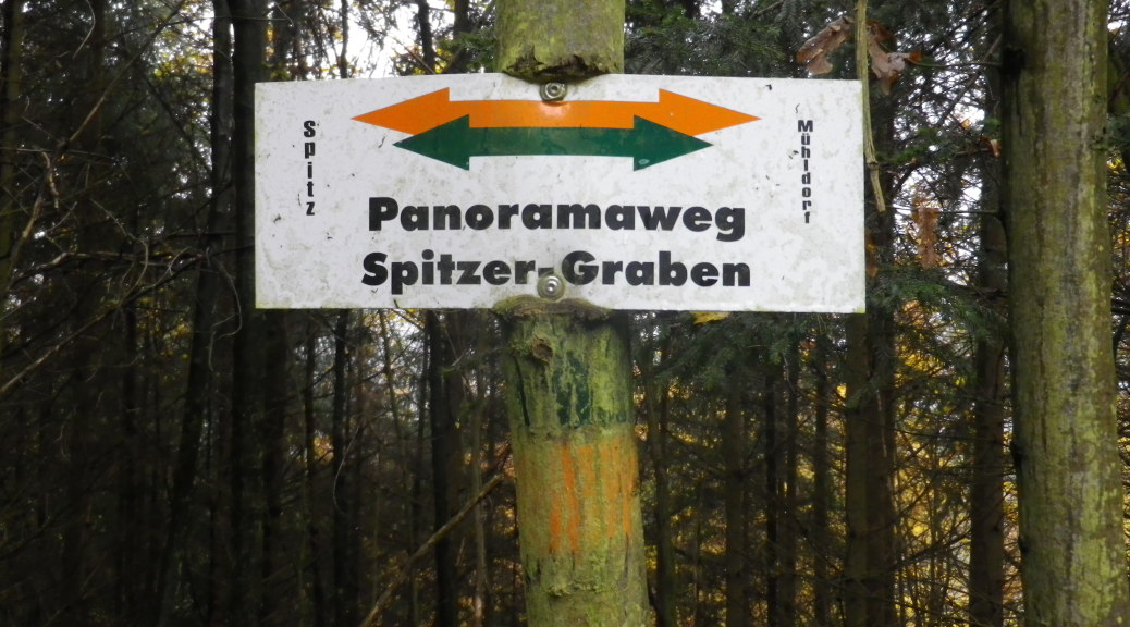
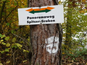
Trail Name: Panoramaweg Spitzer Graben (also advertised as Panoramawanderweg Spitzer Graben)
Trail Type: Long distance hiking trail, well maintained, and rather well-marked.
Length:
Total: 19.7 km/12.25 miles
Segment: @12 km/8 miles
Convenient to: Krems, Austria
Marking: White rectangular signs with “Panoramaweg Spitzer-Graben” in black letters, green and orange arrows (or rectangles on tree, stone or other rough surfaces)
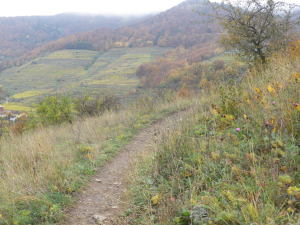
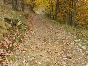
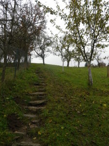
Trail Description: This is a circuit hiking trail ranged mostly along a small river valley, with multiple ascents and descents, some steep, as the route follows along ridgelines, spurs, and the valley. Multiple trail surfaces are present as well, from asphalt to grass track.
Trailheads:
Muehldorf: Marktplatz
Spitz (an der Donau): Kirchenplatz
Parking Possibilities:
Spitz: Spots along Spitz off Donaustr; A few spots on Kirchenplatz; large lot on Schlossgasse;
Spitz to Muehldorf: several designated parking areas along the route on Ottenschlaegerstr/B217
Muehldorf: large lot off Ottenschlaegerstr/B217, almost opposite Lindbergweg
Public Transportation Options:
http://www.anachb.at/bin/query.exe/dn?L=vs_anachb or http://routenplaner.vor.at/bin/query.exe/dn?L=vs_vor
Bus: The Postbus Wachaulinie WL1 connects Spitz with larger towns north (Krems, Weissenkirchen), and south to Melk. Wachaulinie WL5 connects Spitz and Muehldorf, albeit somewhat infrequently.
Rail: Wachaubahn has limited seasonal service from Krems to the north, and Emmersdorf to the south.
Suggested Stages: This trail is designed with several access trails to and from the valley. This enables hikers to join the trail at a number of locations or shorten the trail according to their needs. Link to the Marivino site has suggestions on smaller stages.
Trail Itinerary-Reference Points:
(Start point at Muehldorf)
Out: Muehldorf: Unterranna-Alter Fuhrmannsweg-L7129, past castle/hotel, Niederranna, field/orchard; Muthstal: woods, sign for Eichberg, copse of pines, woodline/vineyards; Elsarn: Bruck (a paved way), Bruckhuette, Bruck; vineyards and woods; Zornberg: Zornberghuette, Zornberg (a paved way); Laaben: sunken way, Haidgasse, wine dispenser and picnic bench, vineyards; Radlbach: Radlbach (a paved way), small settlement, Quitten x Friedhofgasse, (near cemetery and chapel); Spitz center: Kirchenplatz.
Back: (per Marivino site, below) Spitz/Radlbach: In der Spitz; along Spitzerbach/B217 (Spitz Creek); Gut am Steg: Gut am Steg (a paved way), Aussichtspunkt, chapel, L7132; Viessling: Bachstr; Elsarn: Bachstr; Muehldorf.
Representative Trail Photos:
Restrooms: No public facilities observed.
Attractions on or near Trail:
Views of castles, chapels and churches, wineries and beautiful scenery predominate.
Tasting along the Trail:
Spitz: Weingut Langlers
Spitz/Laaben: Weingaertnerei Helmut Donabaum, winery and dispenser right on the trail.
Gut am Steg: Weingut Mayer
Alternative Options:
Hiking: This trail follows a segment of the long-distance trail Welterbesteig Wachau, which would provide a longer-distance, alternative hike through the Wachau wine region, and beyond.
Running: Parts of the trail by Muehldorf would be challenging to run because the grass and step surfaces could be slippery on the steeper declines. Best running would be from around Marillenhutte to Zornberghutte, and the circuit from P2 to Setzberghutte, then P1, and returning to P2.
Biking: A small part of this trail intersected with the 40 kilometer-long Weinsteintour for mountain bikes.
Additional Information:
Regional: http://alt.donau.com/donau/e/portal/default.asp
Trail specific:
Showing circuit: http://www.marivino.at/
Comments:
Different materials describe this hike slightly differently. It is a variously described as a circuit, or as a trail, either of which can be shortened. Different start and end points are given as either Spitz or Muehldorf, although, as with all circuits, you could begin anywhere along the route. Finally, although Spitz Kirchenhof (“Kirchenplatz” is what is shown on maps) was listed as a trailhead, the maps and actual markings on the ground did not show the trail as entering the center of Spitz. All that said, markings were good to follow from one point to the next if general reference points are known along the trail.
Great variety of surfaces, scenery, and changes in difficulty – makes this a wonderful trail to hike.