Trail Name: Ortenauer Weinpfad (OWP)
Trail Type: Long distance; almost exclusively paved or hard-packed earth, well maintained, very well-marked.
Length: Total: 101 kilometers/ 62.75 miles
Convenient to: Baden-Baden (north) and Offenburg (south), Germany
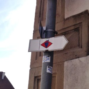
Marking: Blue grapes on a red diamond on a white background
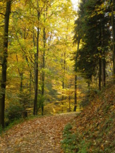
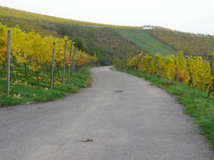
Trail Description: This is a long distance, multi-stage trail that usually follows along the higher elevations of the vineyards in the Ortenau wine region. It just as often passes through forests, thus providing cool shade, and quiet moments in the beautiful Black Forest. It drops down hillsides to pass through villages on occasion, making it easy (with some planning) to hike this trail using public transportation
Trailheads:
Start: Gernsbach, Altes Rathaus
(Mid-point:between Sasbachwalden and Kappelrodeck. See the trail itinerary below for some intermediate trailheads.)
End: Diersburg, Rathaus
Parking: (Southern part of the trail only)
Kappelrodeck: Jahnstr, 2 lots: one next to, one opposite Acherntal Halle;
Waldulm, lot off Weinstr, by the sports stadium
Oberkirch: Renchallee, large lot just off the street
Durbach: Almstr, large lot by the sports fields; Schleife, on street parking spots, but watch for restrictions
Gengenbach: Parking area on Wolfsweg; paid parking plentiful on Friedrich- and Einach- strasse.
Public Transportation Options:
Bus: Bus lines include the Ortenaulinie (TGO, Tarifverbund Ortenau) further south
Rail: Deutsche Bahn regional trains connect Baden-Baden, south to Gengenbach, with stations in Oberkirch and Offenburg.
Suggested Stages: (Official)
Gernsbach – Baden-Baden: 14.5 km
Baden-Baden – Neusatz: 23 km
Neusatz – Kappelrodeck: 11.5 km
Kappelrodeck – Oberkirch: 11.5 km
Oberkirch – Offenburg/Zell: 14 km
Offenburg/Zell – Gengenbach: 18 km
Gengenbach – Diersburg: 10.5 km
Trail Itinerary-Reference Points: (Southern part of the trail only)
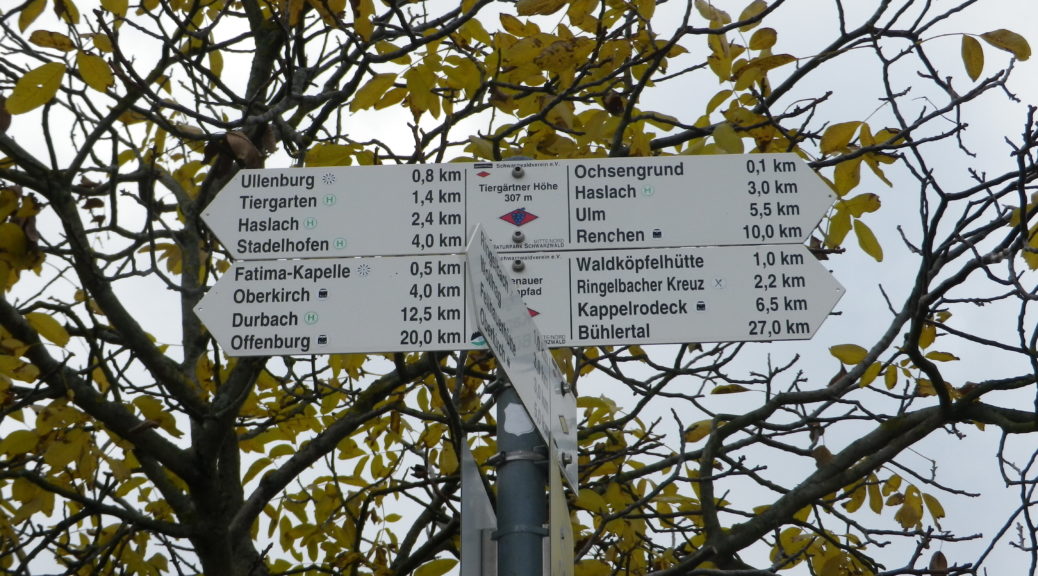
Kappelrodeck: Jahnstr-Eichwaeldeleweg; Vineyards; Waldulm:Ziegelhof, Talstr, Muhlenbach, Oberberg (vineyard path, not street), Gasthof Einkehr, Ringelbacher Kreuz; Tanzberg: Tiergaertnerweg; Oberkirch: Tiergaertnerweg, Krautschollenweg, Hansjakobstr, Hebelweg, Kapuzinergasse, Eisenbahnstr, Renchallee, Butschbacherstr, Am Eckenberg; Bottenau: St. Wendelstr, St Wendel Chapel, woods and vineyards, Waldhutte; Durbach: Schloss Staufenberg, Steingasse, Kirchplatz, Sendelbach, cemetery, Hatsbach, Vollmersbach; Offenburg/Zell-Weierbach: Panoramaweg, Hasengrund, Talweg-Ringstr-Im Albersbach; Fessenbach: Senator Burda Strasse; Froeschlach: vineyards, past the top of St Andreas and Weingut Schloss Ortenberg; Ortenberg: past the top of Waldgasse, past Schloss Ortenberg, woods and vineyards; Ohlsbach: Schlauchberg, Buehlweg, Weissenbach-In der Liesi, past cemetery; woods; Gengenbach: Wolfsweg, past the Klinik, Nollenstr, Viktor Kretz Strasse-Hauptstr-Brueckenhaeuserstr-Burgermeister Herb Strasse; over B 31, through fields and woods; Berghaupten: up vineyards and through woods, Talstr, Fuchsbuehlweg-Weinbergstr-Heiligenreute; Woods; Diersburg: past sports fields, Sportplatzstr, Talstr/Church, Rathaus
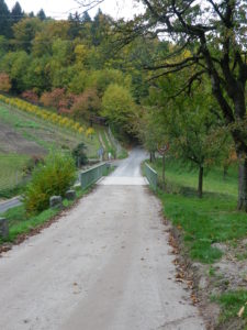
Representative Trail Photos:
Restrooms: (Southern part of the trail only)
Kappelrodeck: Rathaus, Hauptstr (by the garage)
Oberkirch: Kiosk next to train station, on Eisenbahnstr
Durbach: Kirchplatz, and Almstr (in the free parking lot)
Ohlsbach: Hauptstr, by the community buildings and mini-golf course
Gengenbach: Hauptstr, by the Rathaus (small fee)
Attractions on or near Trail:
Lots of beautiful, restful, scenery, and small, photogenic towns
Tasting along the Trail: (Southern part of the trail only)
In addition to many small family run wineries, the following are on or less than 400 meters from the trail:
Kappelrodeck: Hex vom Dasenstein
Oberkirch: Weingut Julius Renner, Oberkircher Winzer
Durbach: Graeflich Wolf Metternich’sches Weigut; Weingut Markgraf von Baden
Offenburg/Zell: Zeller Abtsberg Weinkeller
Ortenberg: Weingut Schloss Ortenberg
Alternative Options:
Hiking: A 16-kilometer circuit named Durbacher Panoramaweg.
Cycling: A medium distance cycling circuit through Sasbachwalden, Kappelrodeck and Oberkirch, the Weinsagen Tour. Click here for details.
Car: Badische Weinstrasse, a 200 kilometer car route for wine enthusiasts, begins in Baden-Baden and ends at Weil Am Rhein (on the Swiss border). It roughly follows Highway 3 from north to south.
Additional Information:
Regional: http://www.ortenau-tourismus.de/ and http://www.baden-baden.de/en/tourist-information/
Trail (segment) specific: http://www.schwarzwald-tourismus.info/Media/Touren/Ortenauer-Weinpfad
Comments:
See details of the northern half of this long-distance trail here.
In Offenburg/Zell-Weierbach, the signs, map and GPX routes can differ. One version has hikers go into Zell center by Rathausgasse, the other climbs stairs from Talweg to Hasengrund, and yet another goes directly to Panoramaweg, which is where all versions meet up again.