There are discrete places that our memory captures in perpetuity for reasons unknown to us. Saarburg was one such place. A combination of road closures, road work detours and searching for a shortcut, took me there one afternoon. One glance at the compact historic center, rising dramatically above the serpentine Saar River, impressed itself so firmly in my mind that when I found a wine-themed hiking trail there, I knew that I would have to return to hike the trail.
The problem was that the trail was long, and I did not have time to complete it all, so I focused on identifying a section fairly well suited to form a circuit, keeping in mind that I wanted to explore Saarburg.
As it happened, the Saarweinwanderweg is a circuit trail itself, and it turns back on itself (albeit on the other side of the river), shortly after Saarburg. So off I went to spend a couple of restful days hiking in this little-known area. While it is little-known outside Germany, it does do a brisk German day tourist trade, with several good restaurants, cafes, and tourist sites.
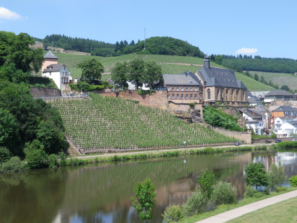
My first detour from the trail, and first renowned tourist site, came right where I began the hike: at the traffic circle by the castle. The Saarburg castle dominates the town, and the river. Situated at the edge of a cliff, it has marvelous views not only of the river, but of the surrounding countryside, which itself was dominated by vineyards.
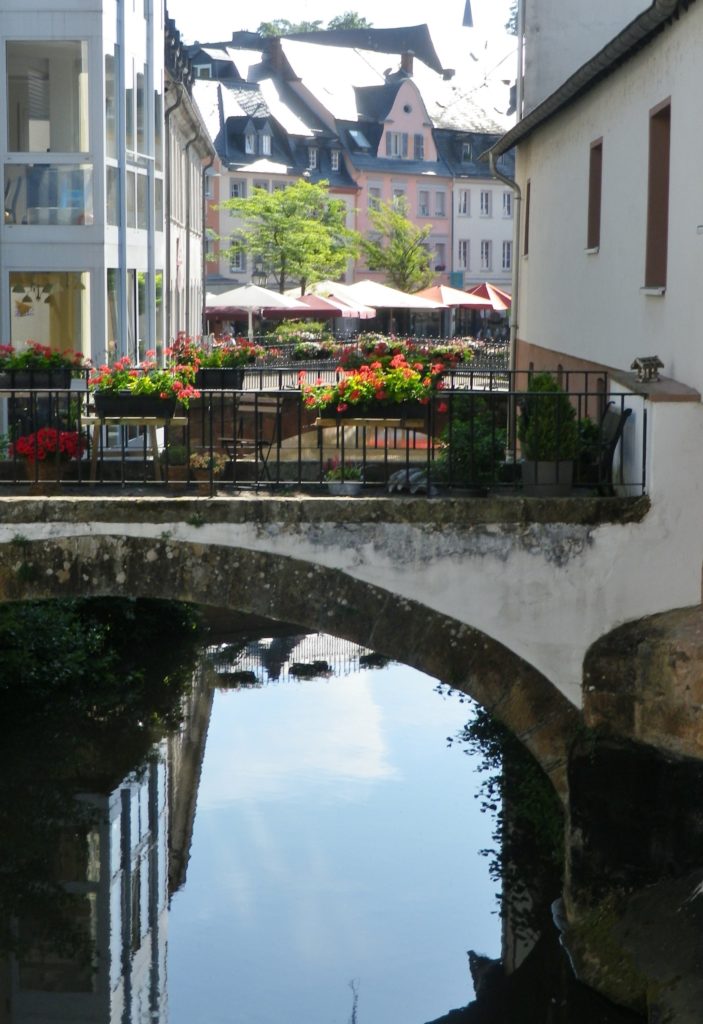
While the trail follows the main (trafficked) streets through town, lined with fun shops and smart eateries, just before the second traffic circle, I took a detour through the pedestrian zone of Pferdemarkt, and meandered a bit around the historic section, with its little bridges over the rushing Leuk tributary, and jumbled together houses. I rejoined the trail just as it left the built-up section of town, above the vineyards fronting the river.
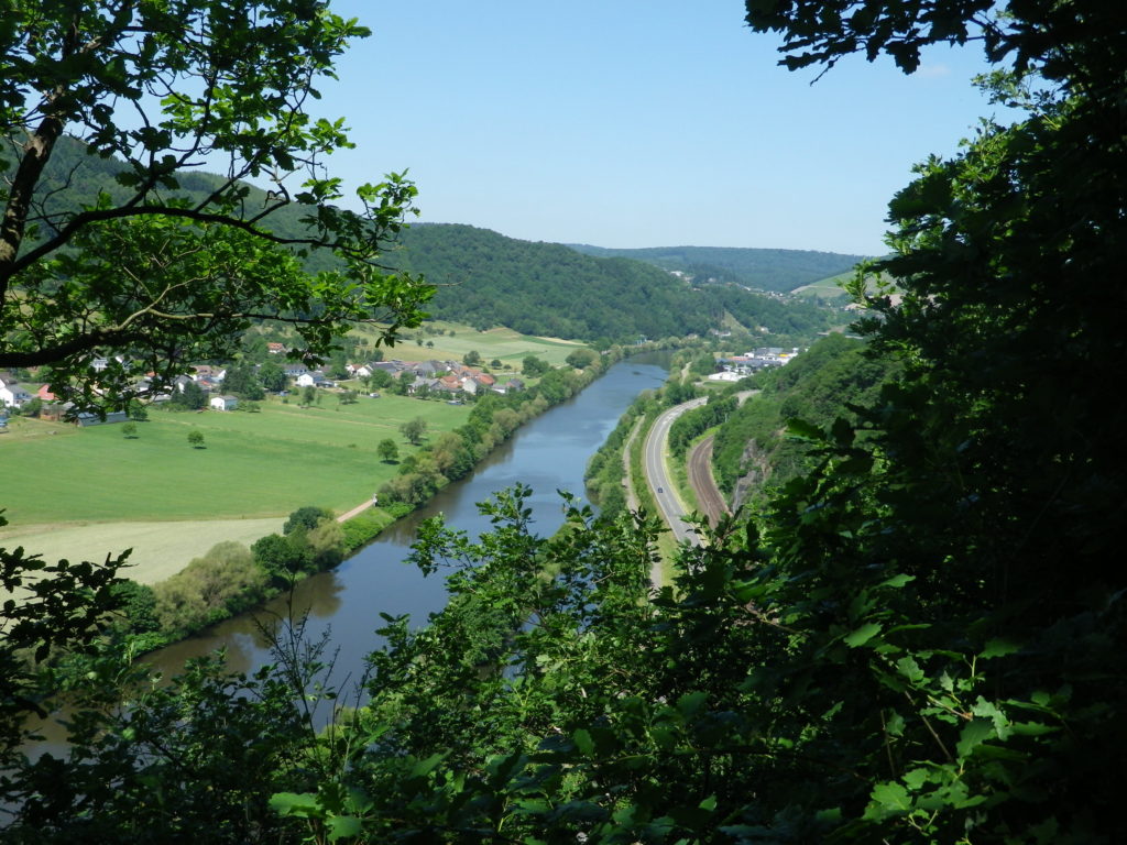
To be honest, the walk along the river was too flat for my taste, and judging from the number of cyclists on the trail, they too found that it was better suited for biking. Indeed, the Saar-Radweg, a 111 kilometer long riverside cycling itinerary ran along the opposite bank. Nonetheless, it was quite pretty, and very quiet, and a good way to warm up for the rest of the trail.
Crossing over the Saar via the lock at Serrig, tarrying a bit to take some photos of the perspective from the river, the trail reached its apex. To here, the trail had followed upriver, and from here it would follow downriver back to the start.
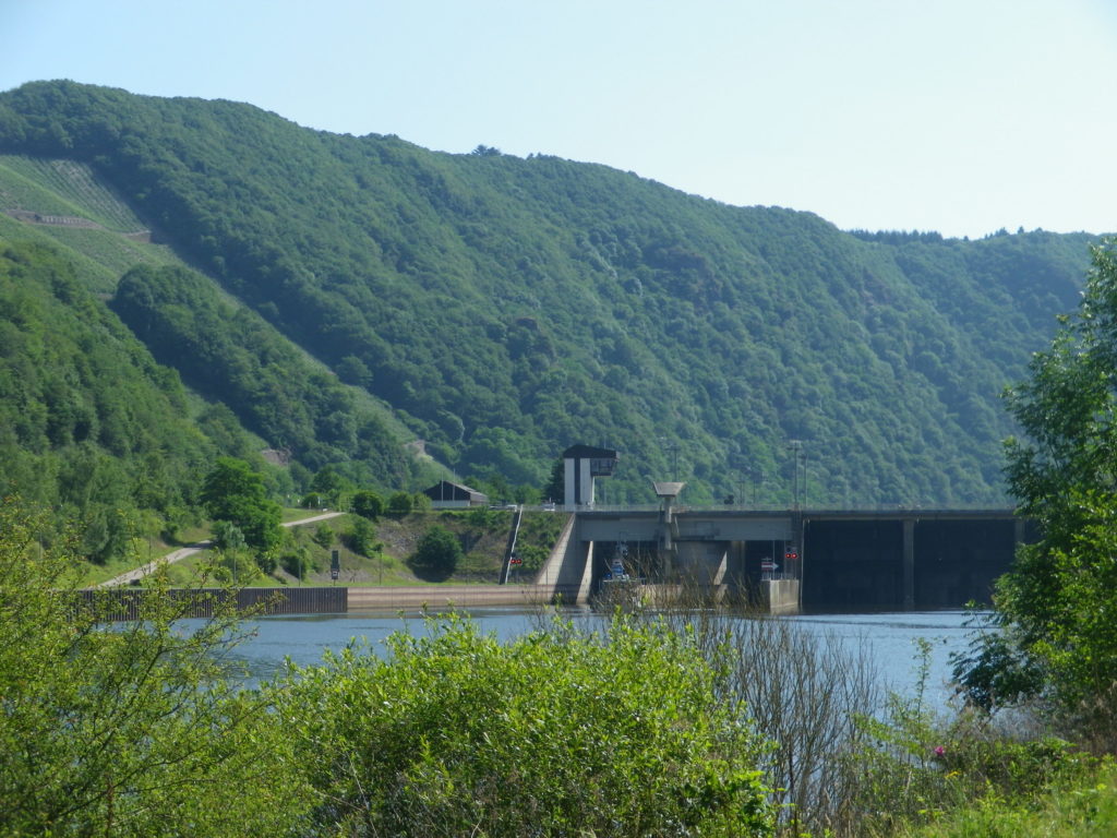
At this point too, my trail segment reached the hilly stage. A couple of long inclines would follow beginning from the outer edge of Serrig, a quiet little town. But this was the easy section, because in the middle part of the trail on both sides of the river, there are numerous inclines, which is why this trail is rated as middle difficulty.
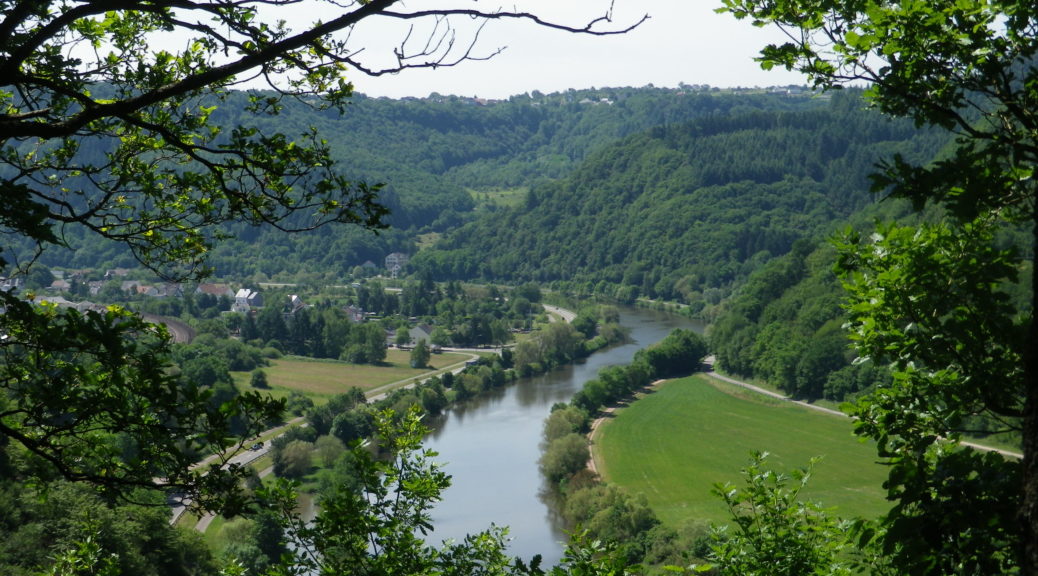
Fortunately, though, except for the first, long incline, the rest of my section was in the cool, shaded forest, high above the river. Along part of the way to Irsch, the river and the opposite hillsides were visible. A couple of lookout points situated on the edges of cliffs (and therefore not for those suffering from vertigo), provided good vantage points for photographs. Cutting away from the river, the trail made a beeline northeast through the forest. Then it descended abruptly into Irsch, another village along this river devoted to viticulture, an appropriate place to end my segment for the day!