Trail Name: Markgraefler Rebland Radtour
Trail Type: Middle distance; bicycle circuit almost exclusively paved, largely on dedicated bike trail or lane; well maintained and signed, albeit not specifically marked for this trail.
Length: total: 35 km
Convenient to: Freiburg
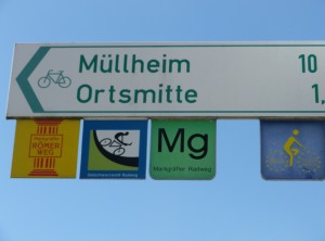
Marking: Green and white bike directional marking only. (No marking specific to this trail.)
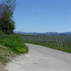
Trail Description: This trail follows up and down the ridges on which the Markgraeflerland grapes are grown. It passes through picturesque small villages and towns, and offers wonderful views of the Rhine River Valley, from Black Forest range to the east, and the Vosges Mountain range in France to the west.
Trailhead:
Official: Badenweiler, Schlossplatz
Mine: Heitersheim, Johanniterstr (near Villa Urbana)
Parking Possibilities:
Badenweiler: large lot on Ernst Eisenlohr Strasse; Unterer Rebweg, two small lots for hikers;
Staufen: Am Schiessrain (off Schladererstr), or Bahnhof (BH str)
Heitersheim: Johanniterstr
Public Transportation Options:
Bus: SWEG (Suedwestdeutsche Verkehrs-Aktiengesellschaft) bus lines service this area.
Rail: Deutsche Bahn trains connecting north (to Freiburg and beyond) and south to Weil am Rhein and Basel serve Heitersheim and Staufen (via Bad Krozingen).
Suggested Stages: Not applicable
Trail Itinerary-Reference Points: (Counterclockwise)
Badenweiler: Schlossplatz, Ernst Eisenlohrstr-Weilertalstr/L131, Niederweiler/cemetery, L125; Zunzingen: Rosenbergstr-Dattingerstr, L125; Britzingen: Markgraeflerstr-Buggingerstr-Loehlefeldstr; Laufen: Bachtelstr-Weinstr (L125), cemetery, Eichgasse, L125; Dottingen: Laufenerstr, Sulzbergerstr-Neumattenstr, Rebgasse; Ballrechten: Otto Karrer Str, Weinstr; Past Grunern on Ballrechterstr; Staufen: Grunernerstr, Hauptstr-Bahnhofstr-Gruenmatten, Neumagenstr, Im Gaisgraben; bike trail; Oberkrozingen: Kapellenstr-Schmidhofenerstr, (cross B3); Schmidhofen: Felix u. Nabor Str; Gallenweiler: Schmidhofenerstr-Oberer Gallenweilerweg; Heitersheim: Staufener Str, Johanniterstr-Badhausstr, Honiggasse; Malteserstr; Betberg: Buggingerweg (cross Sulzburgerstr); Buggingen: Gebirgstr-Hauptstr, past cemetery; L125, and start of Badenweiler loop; At cemetery/Niederweiler keep right onto Gottesackerweg-Weilertalstr-Lindenstr-Romerstr-Schlossbergstr, to start point.
Representative Trail Photos:
Restrooms:
Badenweiler: Parking Garage, pedestrian entrance
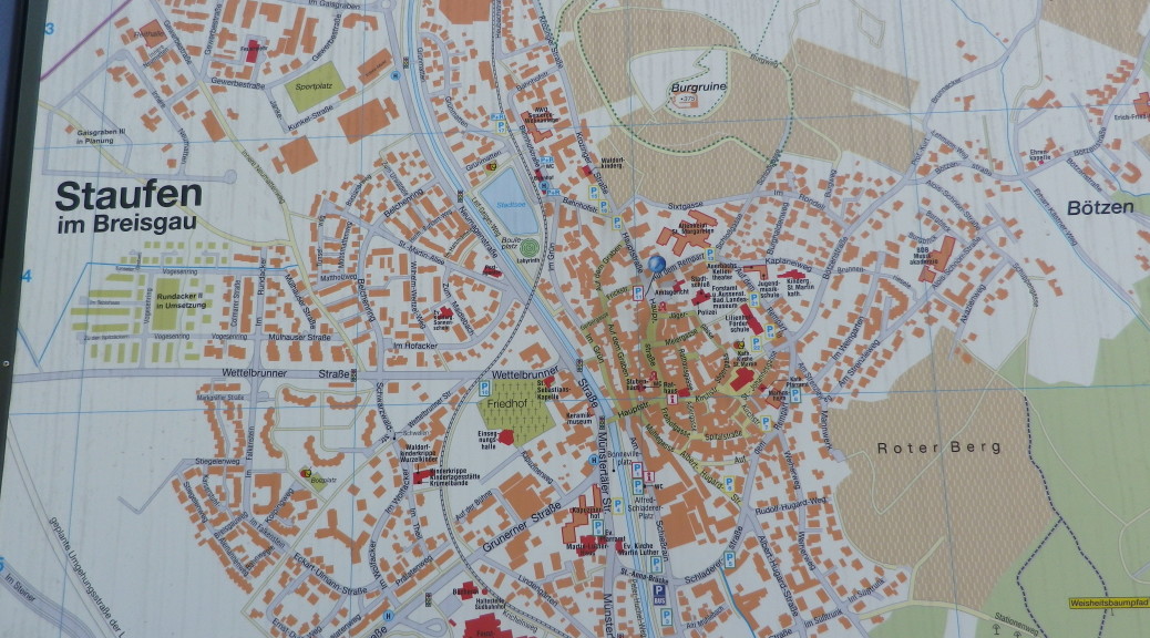
Staufen: Muenstertaelerstr: on the old town side of the river between the 2 bridges
Attractions on or near Trail:
Badenweiler: Roman bath ruins, modern spa, beautiful Kurpark with amazing old trees, castle (Burg Baden)
Staufen: historic town center with lots of half-timbered houses and old city wall segments, outdoor wine bar, castle ruin (but be ready to climb)
Heitersheim: Roman museum in the Villa Urbana excavation site
Tasting along the Trail:
Wineries abound, but in Laufen, Heitersheim, and Britzingen are directly on the trail
Staufen: Winzergenossschaft Staufen also has a popular outdoor wine bar
Alternative Options:
Hiking or Running: This entire trail may be hiked or run
Biking: The southern section of “Radwege durch das Weinland Baden” is a 237-kilometer-long trip through Baden’s Markgraeflerland, Breisgau, and Ortenau wine regions, from Basel to Baden-Baden.
Car: Badische Weinstrasse Car Route, covers this area and more, extending from Basel to Baden-Baden
Additional Information:
Regional: http://www.schwarzwald-tourismus.info/schwarzwald/Regionen-im-Schwarzwald/Markgraeflerland
Trail (segment) specific: http://www.outdooractive.com/de/radtour/suedlicher-schwarzwald/radtour-nach-staufen-durch-die-weinreben-von-badenweiler-aus/10978194/
Comments:
On average, this is an easy trail, considering a long stretch is on flat plain. However, there are some more challenging hilly sections between Badenweiler and Ballrechten.
Need either the GPX coordinates or a good map to follow this itinerary. See the trail link above for both.
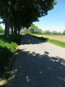
There are a couple of shady sections of the trail. Otherwise it is mostly in the sun.