The Mittelhaardt is a lively district in September and early October, because this is when Neustadt an der Weinstrasse holds its famous Weinfest, preceded by the Wurstmarkt, in Bad Duerkheim. These are two of the most popular wine festivals in the Mittelhaardt. These two small but fun towns, about 11 miles apart, are joined by the German Wine Route Hiking Trail, as it makes its way through the Mittelhaardt wine district of the Pfalz.
After finishing the southern half of the same trail, leading through the Suedliche Weinstrasse wine district to Neustadt, I later continued north through the town and into the nearby vineyards.
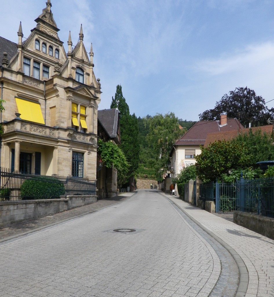
Neustadt is centuries old. Some of the narrow, twisting lanes in the old city center evoke its medieval era. But in the Haardt neighborhood above the town center, just before entering the vineyards, the architecture and mood changes, reflecting the overall well-being that existed in Germany in the late 1800s until World War I. Stately town villas, often serving as wine estates, line the route. Some are in the neo-classical style, some are in the neo-gothic style with romantic elements, and there are touches of Jungendstil (known as art nouveau elsewhere). Jungendstil as a style, with its emphasis on natural, often plant-like curves and lines, is particularly relevant here, where grape vine tendrils flow in unruly, sinuous lines from the vines just outside of town.
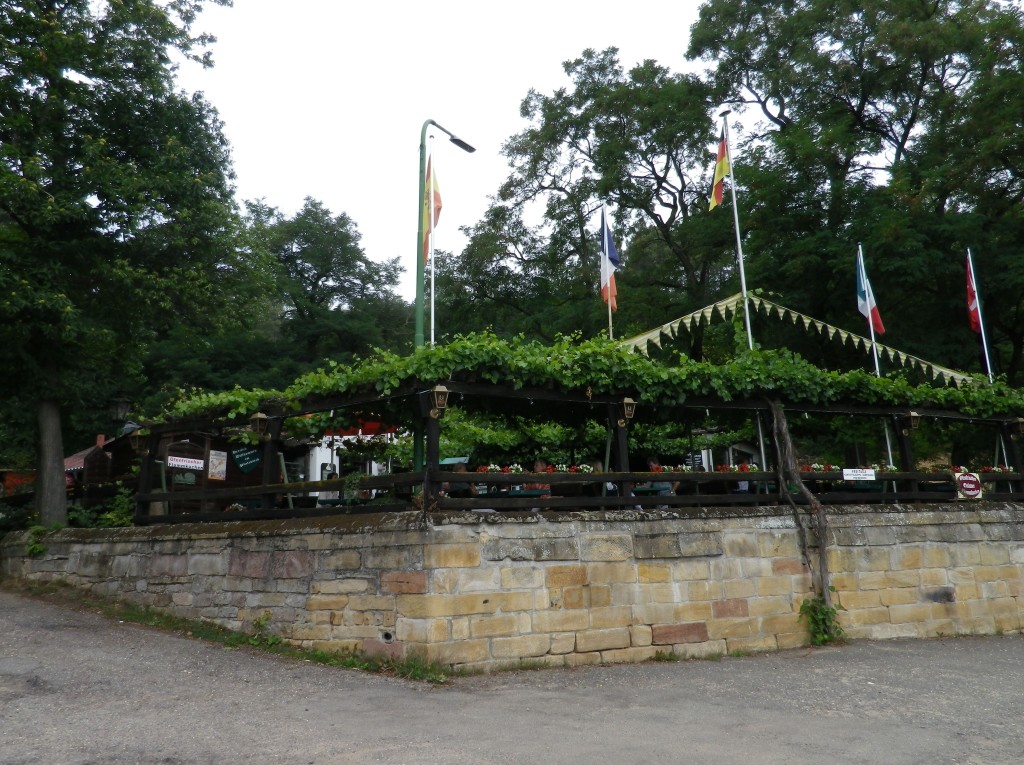
Onto Gimmelsdingen, and then into Koenigsbach, both little villages at the edge of the forest, before coming to a lovely tree-lined path. From here, the vast expanse of Mittelhaardt vineyards spreads out below. This is wine country par excellence, and before long, a great gasthaus appears on the edge of the woods, offering more vineyard vistas, and a restful spot for sampling wines.
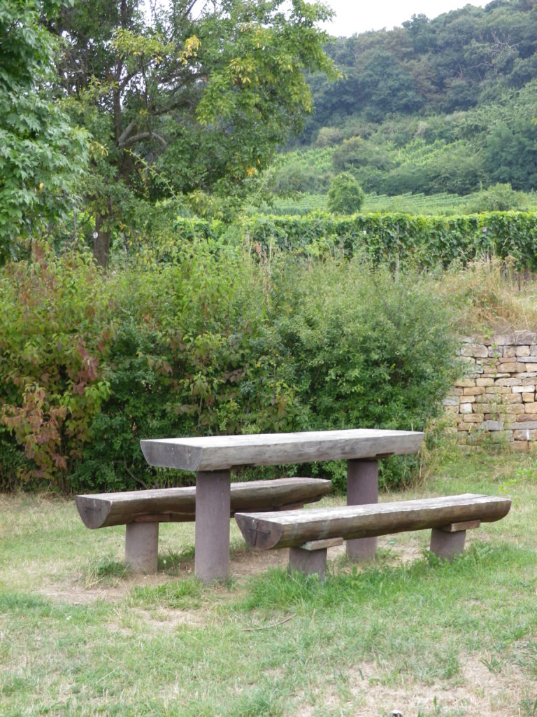
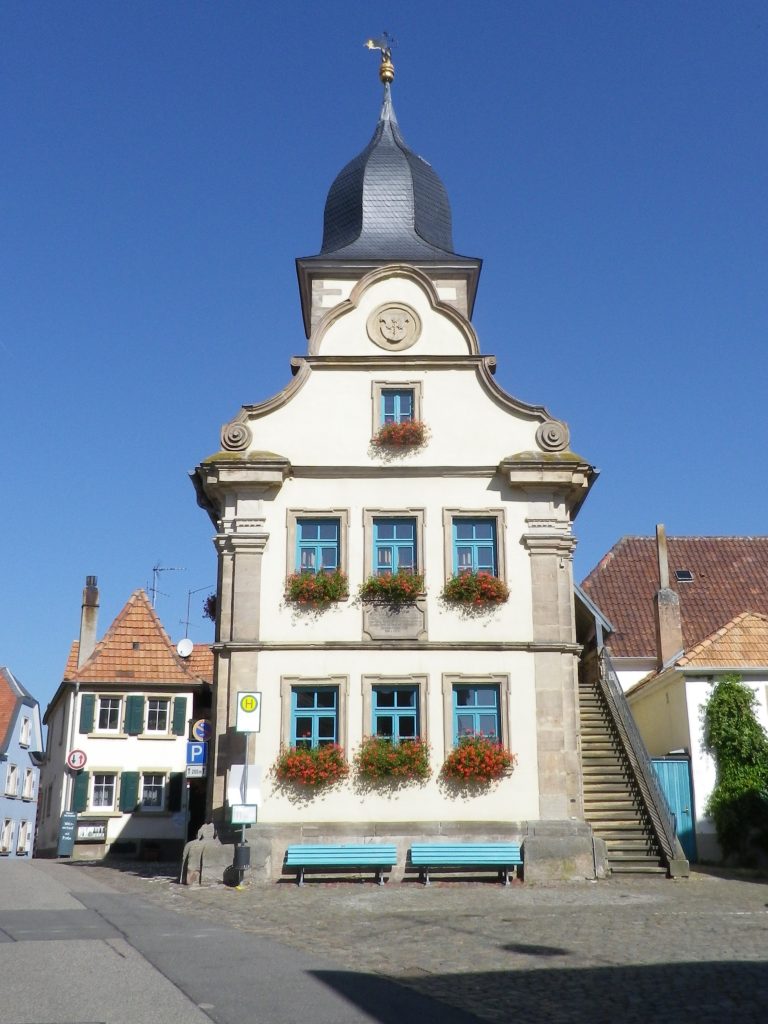
The hike then follows through some of the better known area vineyards, the names of which you may have noticed offered on the gasthaus wine list . But this was vineyard hiking with a twist: benches, picnic areas, green grassy areas for sitting and lying, and explanatory signs for the curious. It falls at the edge of the village limits of Deidesheim, a small place, with a huge fame for its wines.
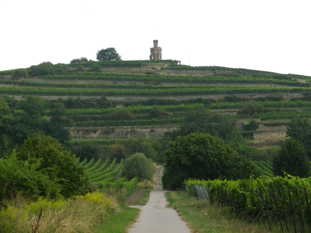
From there to the village of Wachenheim the walk is mostly level. Wachenheim abuts a hill with a castle, with food and drink available for those inclined to follow the well-marked path to it. (It isn’t far off the trail, and the walk is not that difficult.)
From the village outskirts, to the outskirts of Bad Duerkheim, the trail passed through more vineyards, as they rose and fell with the contours of the land. Suddenly rounding a copse of trees, Bad Duerkheim appeared. And a couple of minutes later, heavy rain and lightning suddenly began. Low, pewter-colored clouds had been ominously pushing east, from behind the mountains, all day. Huddled with other hikers under the garage overhang of the first house in town, we compared notes on our experiences on the trail. When the lightening stopped, we covered the less-than-half-mile distance the train station in a lighter shower, and rode the train back to Neustadt. While a couple descended the train at Deidesheim (which village has a lovely 4-star hotel), everyone else descended at Neustadt, where it turned out, we had all parked to hike this segment. As I wrote in the introduction for this series on the Deutsche Weinstrasse Wanderweg, hiking doesn’t get much more convenient than this!
At long last, my goal of completing the hike of the entire German Wine Route Hiking Trail was within reach. And on this final day, it was a glorious weather again, warm and sunny, as had been for much of my hike along this trail.
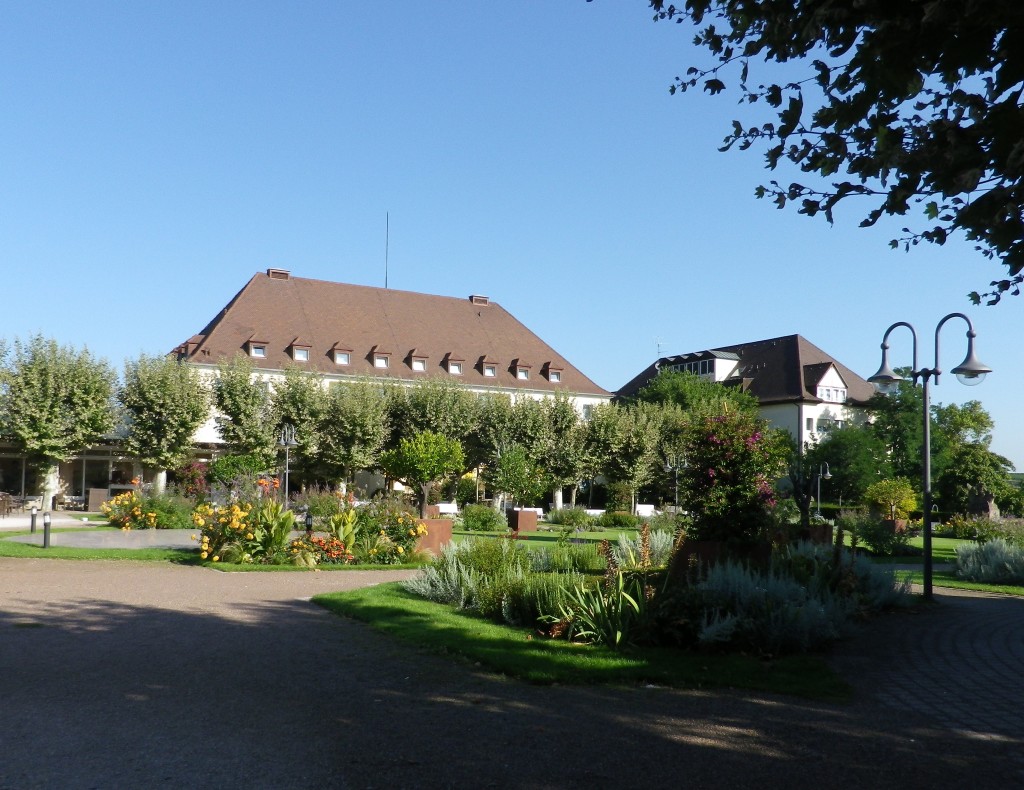
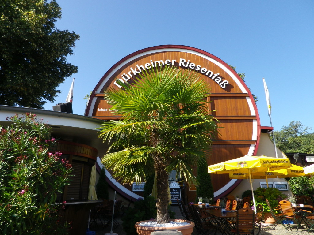
This leg began in Bad Duerkheim, the “bad,” indicating it is water cure town. Accordingly, it has spas and impressive flowery public parks, for the many spa guests, as well as vacationing hikers. Therefore, visitor accommodations are many and varied: from simple to upscale lodging, and eating establishments from cafes to elegant restaurants serving some of the area’s best wines. One café/restaurant is uniquely housed in the world’s largest cask, a local landmark and tourist attraction. It is also only a few yards from the start of the trail for this segment. So after a couple of photos, I headed for the edge of town.
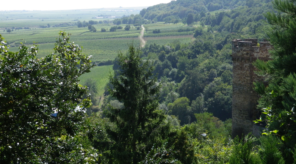
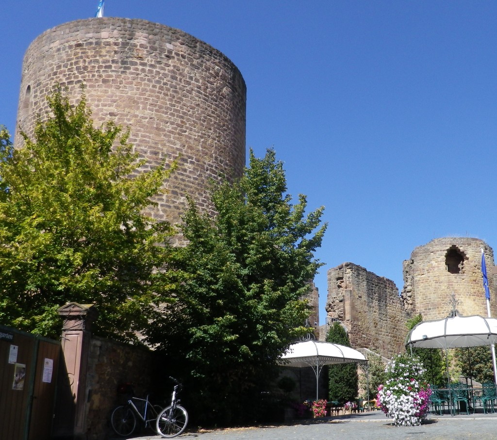
Leaving Bad Duerkheim, my hike north through the center of Leistadt and beyond, seemed like it was all uphill. The high point, figuratively, albeit not literally, was Neuleiningen. Even from afar it looks an impressive stronghold. Developed by local counts in the mid-1200s, it commands a peak overlooking much of the Rhine River valley, both north and south.
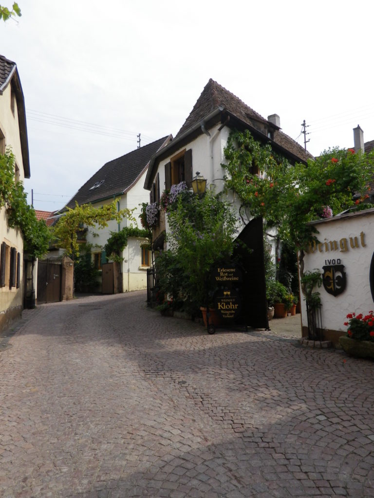
The town itself is impossibly atmospheric: steep, winding alleyways, worn steps connecting higher and lower streets, half-timbered houses, and of course, a castle ruin (an intact tower, walls and an impressive north face showing gothic window framing). Next to the castle two equally atmospheric restaurants, both with outdoor seating, tempted me with seasonally appropriate menus: chanterelles, watercress-based salads, plums (in season), and quality local wines.
It was a climb to reach the top of Neuleiningen and its scenic overlook, but the views were worth it. I thought I had reached the high point of the tour, but noooo…
Although only 10 or so kilometers from the end, the final stretch from Neuleiningen to Bockenheim an der Weinstrasse wasn’t going to be easy. It continued to climb a ridge to above the vineyards, but not in the tree line. Hot, mostly shadeless, and long slogs up steep ridges, it avoided towns and villages, and I hadn’t brought enough water. Eventually though, on the path by Asselheim, I came to a cemetery, made a beeline to the water spigot, doused my head and neck, and refilled my water bottle. The trail designers or the town authorities probably didn’t have such a use in mind, but I was desperate, having finished all my water about 5 kilometers before.
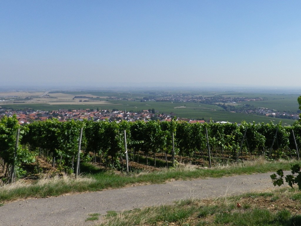
Thus fortified I moved onward through more vineyards offering great views out to the famous, old city of Worms, less than 12 miles away on the banks of the Rhine.
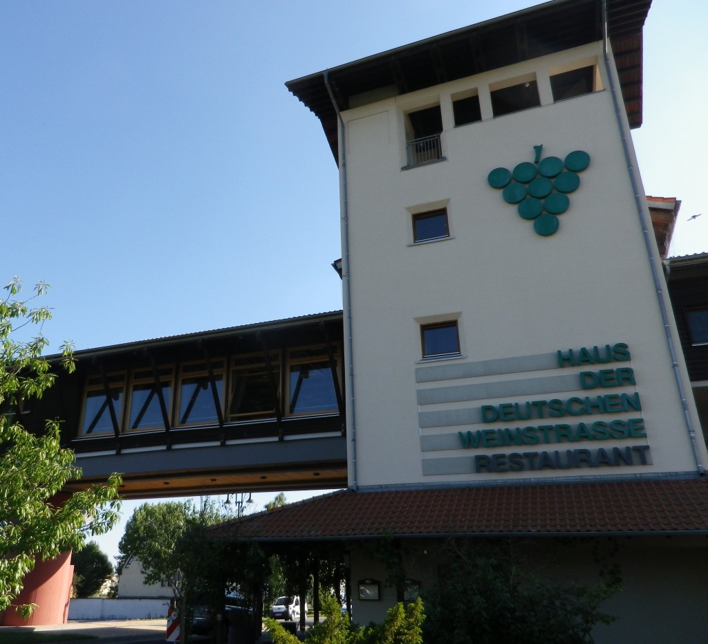
I was excited to see the traditional trailhead: the Haus der Deutschen Weinstrasse from the trail, anticipating it would be as convivial as the one in Schweigen, at the southern end of the trail. Although the women in the tourist information office there were immensely friendly and helpful, they could do nothing about the forlorn air of the closed café/restaurant housed in the same building. Not more than 50 meters away though, was a Kneipp bath: a cold water footbath! Taking the boots off, I walked in – my last steps on the trail. A most appropriate and enjoyable way to celebrate the completion of the classic German Wine Route Hiking Trail!