Following hard on the heels of the longest circuit hike I have done to date, comes the shortest one. Both were in the German wine region of Baden, albeit one in the most southern district of the region, and the other in one of the northern-most districts. Both were fun to hike, although I must confess I found this trail more to my taste aesthetically.
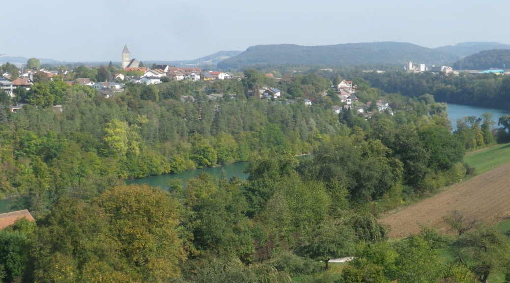
As a personal goal, I intend to hike all wine districts close to the Rhine River, be they in Switzerland, France or Germany. (While there is one vineyard close to the Rhine in Austria, no vineyard trails are in the area.) The Rhine itself is divided into five sections: The Alpine Rhine, the High Rhine, the Upper Rhine, the Middle Rhine and the Lower Rhine. This trail, in the High Rhine area, provided a unique opportunity to explore life and wine-making in the cure town of Hohentengen am Rhein, where the trail began and ended.
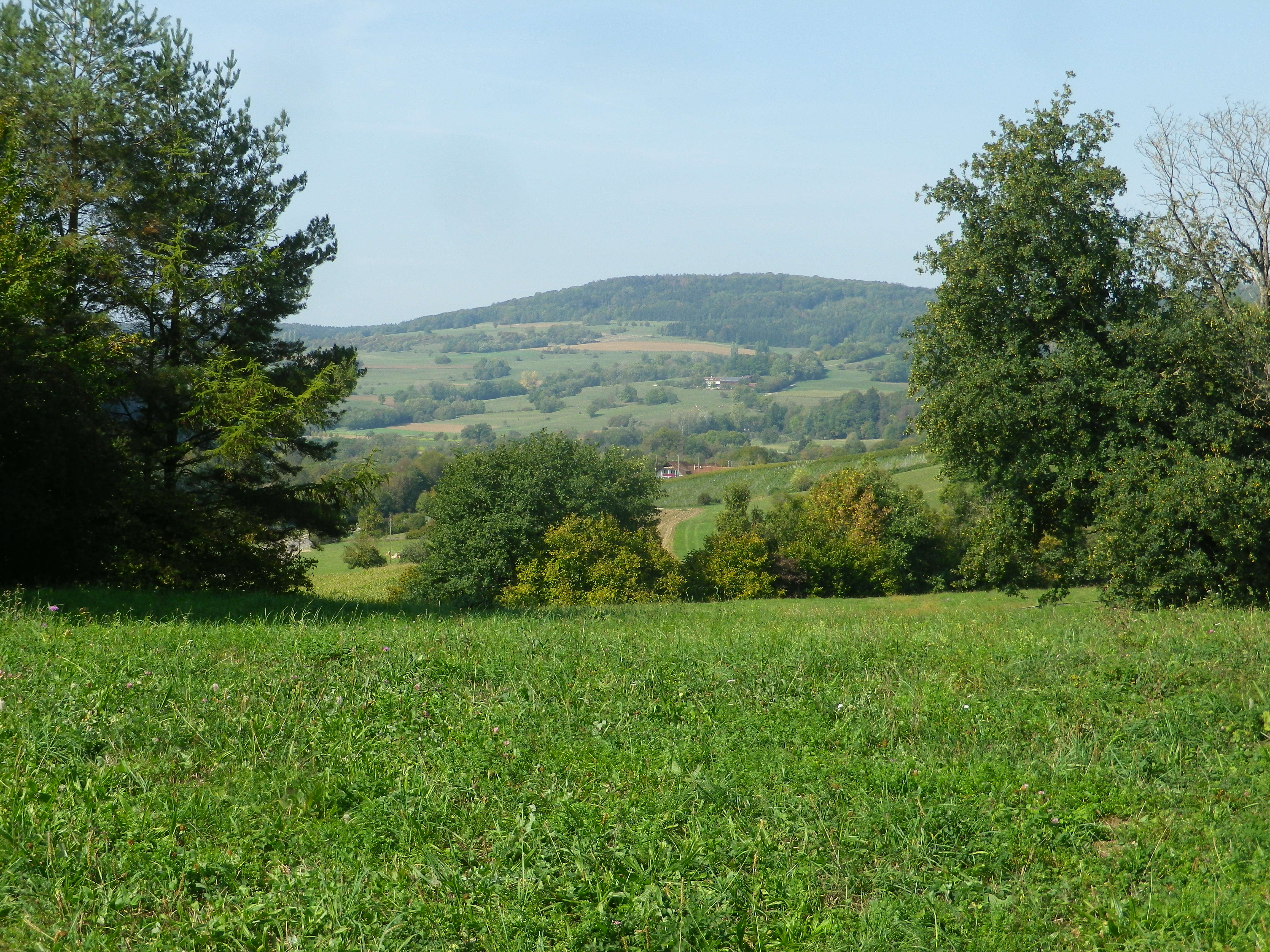
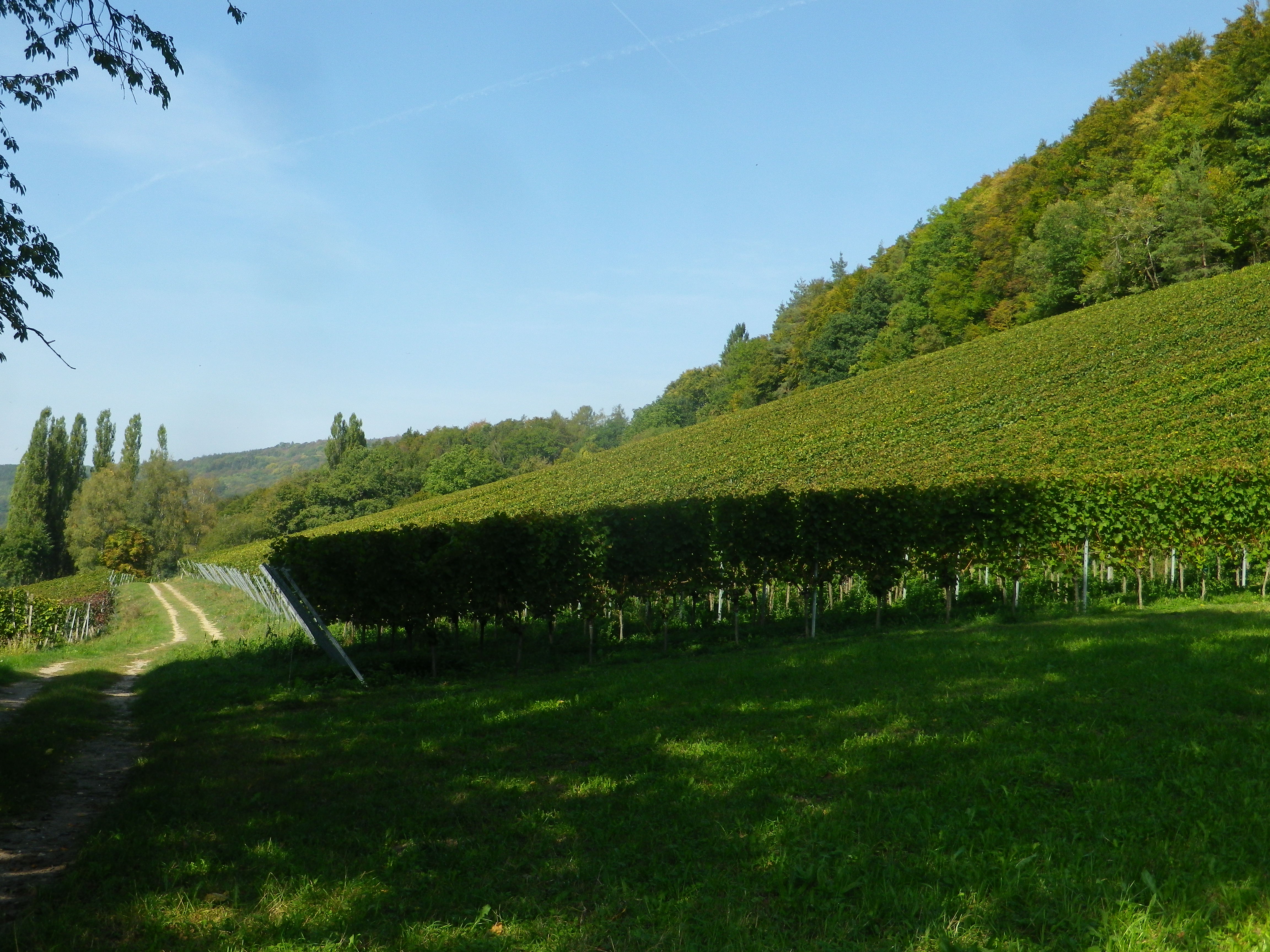
This town is home to the Oelberg parcel and the Engelhof Winery. The vineyards lie west of the town just below the forested hilltops. While the trail did not reach the forest, it came close, and represented the one ascent involved in this trail. After passing through orchards, from which great photos may be had, the trail reaches the vines. The vine-covered slope offered a great southern exposure, which is fortuitous for the generations of vintners here.
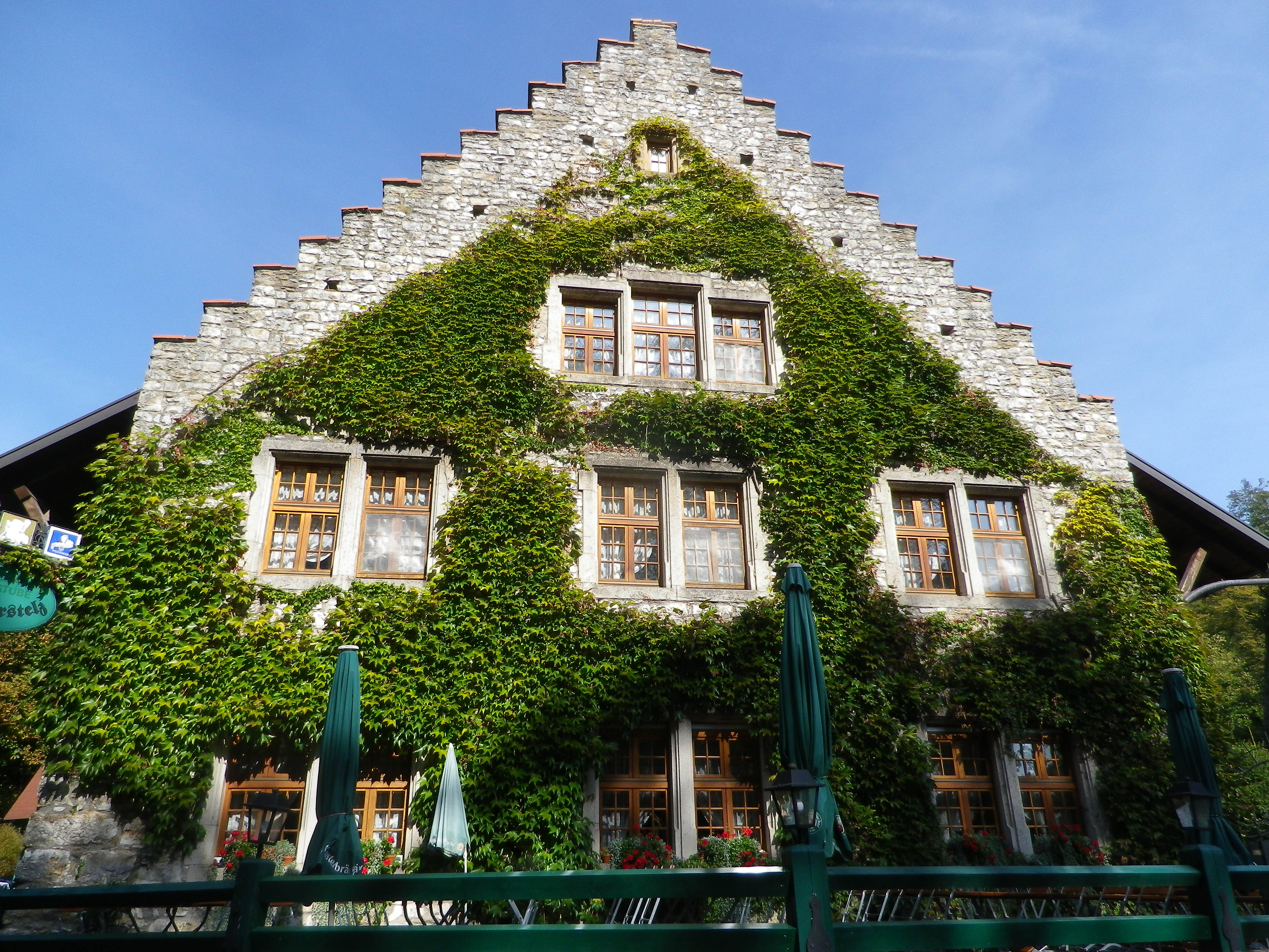
From there, the trail descended to a tavern, the Gaststube Wasserstelz. It was a lovingly maintained stone structure, tucked between the river and a hillock, which offered delicious food and local wine. Since I had finished the “climbing” part of the trail, I uncharacteristically stopped for lunch, and was very impressed with the quality of food, service and the warm, wood-paneled interior.
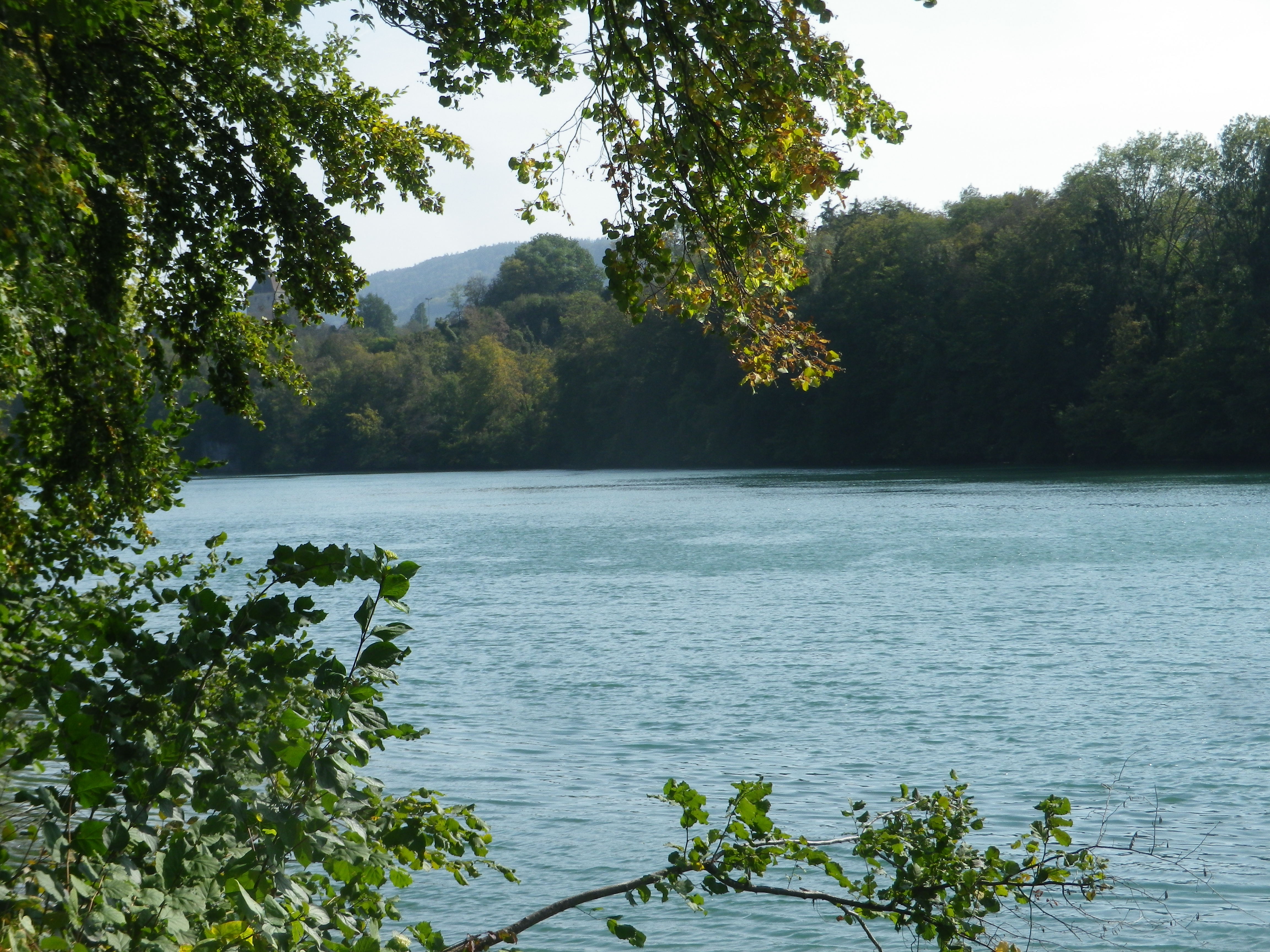
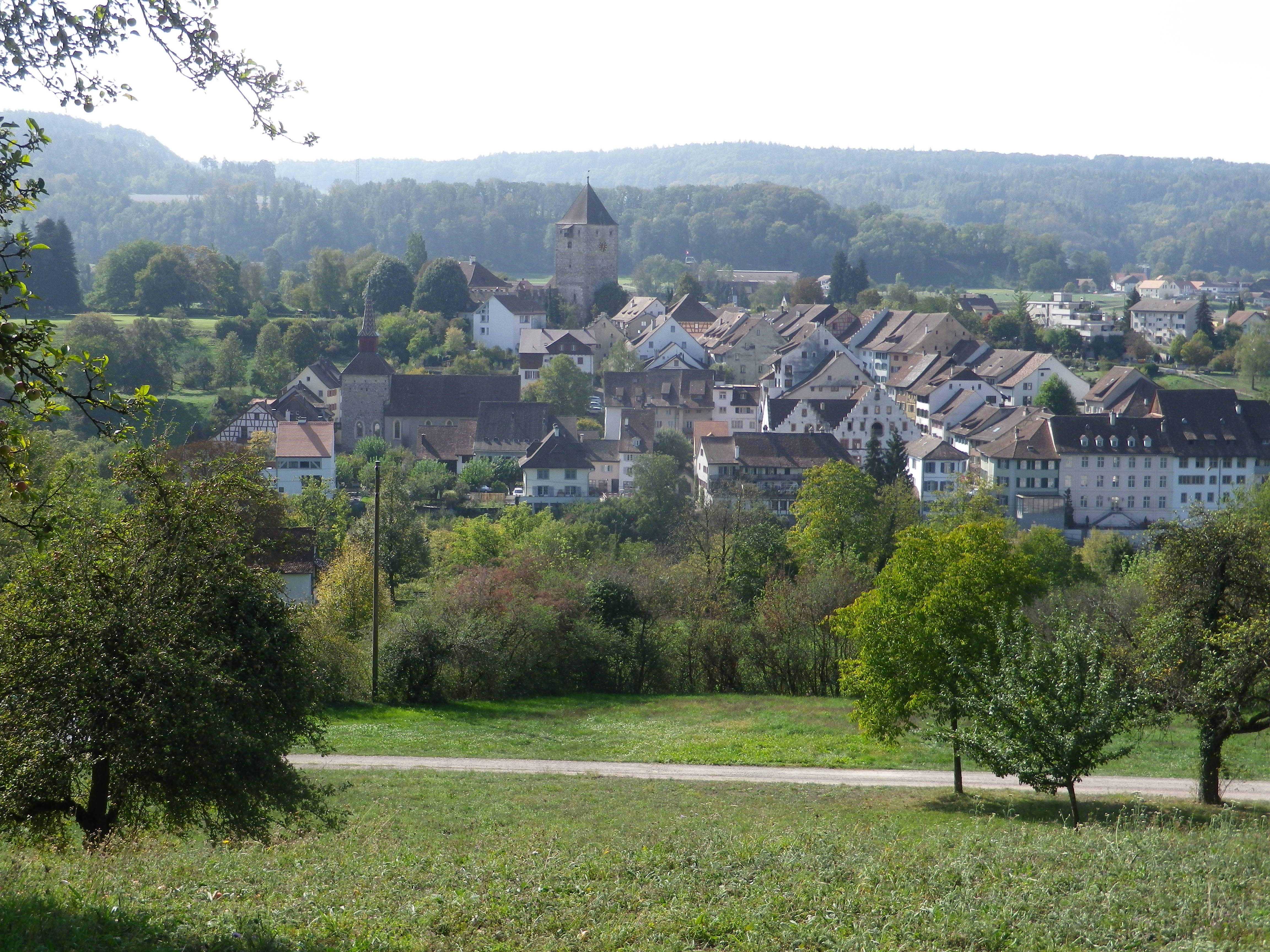
After lunch, I continued along the trail, which after the stretch through the town and vineyards, concluded by following along the river’s bank. In an unusually warm and sunny October day, the river sparkled, and sunlight dappled the path under the trees. When I came to the bridge connecting Hohentengen am Rhein, Germany, with Kaiserstuhl, Switzerland, I decided to cross the Rhine into Switzerland. The 300-meter detour is more than worth the “effort.” Photo opportunities abound from the bridge: of the river, of the town, of the hills… Kaiserstuhl itself is quite picturesque, and a walk up the pedestrian zone will bring you to an old city gate-tower, which when open, provides wonderful wide-ranging views of the surrounding area on both sides of the Rhine.
Returning to Germany, I finished the circuit, and decided to return for another visit someday to this restful area. Many hiking and biking trails are in this area. Among them the High Rhine High Way (Hochrhein Hoehenweg), a 125-kilometer-long hiking route connecting Basel, Switzerland, with Schaffhausen Switzerland, but passing mainly through Germany, albeit not through Hohentengen itself, as well as the 1230-kilometer-long Rhine Cycle Route (aka Euro-Velo 15), which in this section of the Rhine offers a choice between a northern, German segment through Hohentengen and a southern, Swiss segment passing through Kaiserstuhl. So many opportunities, and so little time!