Trail Name: Gorizia a Cormons (AKA: Slow Collio, Un Paesaggio da Bere)
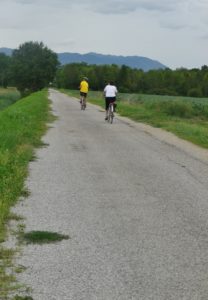
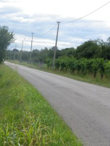
Trail Type: Short distance cycling circuit (with a short tail from Gorizia); about half on lightly travelled paved roads through and between towns, and half on improved earthen trails through countryside, mostly in a protected nature zone; well maintained, but the route itself is well-marked in places, but not in others.
Length: 23 kilometers/ 14.3 miles
Convenient to: Udine, Gorizia, Italy
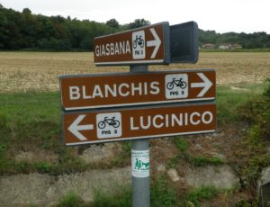
Marking: FVG3 and Slow Collio.
Trail Description: A short and easy cycling circuit, for sturdy street bikes, hybrid bikes or mountain bikes through Collio vineyards and associated towns.
Trailhead:
Mossa: (Circuit only option) Intersection Via Antica Castello/SP49 and Via Carlo Collodi
Gorizia: (Circuit with a tail option) Palasport/Stadium, Via delle Grappate (to Via Sottomonte, to start point above).
Parking:
Gorizia: Stadium, Via delle Grappate, unimproved, and often a busy, lot
Mossa: Via Dello Sport, unimproved area by the sport fields
Cormons: Piazzale Sfiligoi, Piazzale degli Alpini, both large, improved lots
Public Transportation Options:
Bus: Covers smaller towns like Mossa and Capriva; Check for schedules and stops at the Azienda Provinciale Trasporti website for Gorizia, at www.aptgorizia.it
Rail: Ferrorvia dello Stato rail systems has regional trains between Venice, Udine and Trieste, stopping in Cormons and Gorizia; Check the website at www.trenitalia.com
Suggested Stages: Not applicable
Trail Itinerary-Reference Points: (Clockwise)
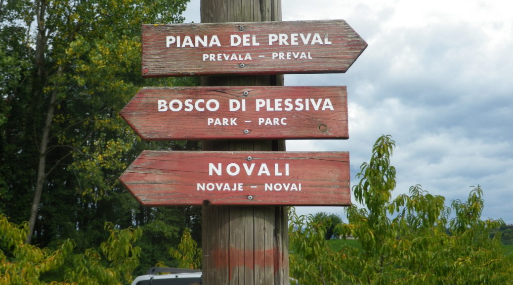
Gorizia: head west, pass under train tracks, V. Sottomonte; Lucinico: V. T. Tasso-V. Fonda; Mossa: Via Antica Castello-SR409, V. IV Novembre; Capriva del Friuli: V. Dante A, V. Battisti; Capriva del Friuli: V. Dante A, V. Battisti-V. Capriva; Cormons: V. Capriva, V. Gorizia, V. Matteotti, Pza XXIV Maggio (cathedral), Via Dante/SR 409, Via Subida/SR 409; Subida: At the top of the hill, downhill from the Church del Crocefisso, take the first right onto an unimproved road, follow the sign for Preval, and then FVG 3 signs, pass little lakes/ponds, to V. Russiz, V Preval, along a drainage/irrigation canal, follow FVG 3 signs to Mossa, on road called Localita San Roc di Luzzinis, to V. Antico Castello.
Representative Trail Photos:
Restrooms: None observed
Attractions on or near Trail: None observed
Tasting along the Trail:
Wineries and taverns abound along the trail, especially on the first half from Mossa to Cormons.
Alternative Options:
Walking: Sentiero delle Vigne Alte, a short, six-kilometer circuit trail (three out, and three back), connecting La Subida, outside Cormons, and Castello di Spessa. The trail signage, once you find the trailhead is allegedly okay, but maps, and precise information, are hard to come by online or with the tourism websites. Italian netizen blog postings and comments on the trail are overall very positive, especially from those with children and dogs in tow.
Car: Strada del Vino Collio, a car route, covering the towns on the cycling circuit, and more.
Additional Information:
Regional: http://www.turismofvg.it/
Trail (segment) specific: http://www.turismofvg.it/it/87777/Da-Gorizia-a-Cormons
Comments: I would recommend this circuit for families with pre-teens and teen-agers, because in spite of being on some lightly-traveled roads on the first half, the second half of the circuit is on dedicated cycling path, lined with all kinds of flora, and with beautiful scenic outlooks throughout.