Trail Name: Entre Vignes et Ramberge
Trail Type: Short distance circuit; almost exclusively paved, well maintained, and fairly well-marked marked.
Length: Total: 8 kilometers/5 miles
Convenient to: Amboise, France
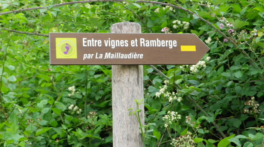
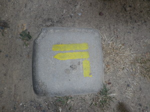
Marking: Wooden plaques identify the trailheads (See above); Yellow lines, straight or bent to indicate direction, below.
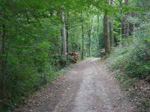
Trail Description: This short, easy trail provides a great outdoor activity for a warm, sunny day. It was quite shady under the summer vegetation, the climbs were very moderate, and the distance rather short. It follows mostly through woods, passing fields and some vineyards. It began and ended in a small village, itself the site of a lovely, shady park by the Ramberge stream – ideal for picnics.
Trailhead: Saint Ouen les Vignes: Place de l’Eglise, or Rue de la Fontenelle
Parking Possibilities: Saint Ouen: R. Jules Gautier/D431, a medium-sized parking lot
Public Transportation Options: None observed
Suggested Stages: Not applicable
Trail Itinerary-Reference Points:
Saint Ouen: past the church, R de l’Aitre Vert, D431/R. Jules Gautier, R. de Fontenelle, through woods, along the stream; Impasse de la Longueterie (toward the end); Through woods; La Maillaudiere, La Piniere; Route de Vigneau; Le Vigneau; Path, through woods, bridge; Route de la Fontenelle (on the edge of La Fontenelle); Imp. Le Jeune Jouet; Back onto R. de la Fontenelle; Follow to 3-armed Y intersection: Impasse Le Jeune Jouet-Route de Vigneau-R. de la Fontenelle, follow straight on R. de la Fontenelle, R. Jules Gautier, to trailhead.
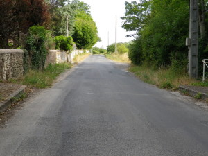
Representative Trail Photos:
Restrooms: None observed
Attractions on or near Trail: None observed
Tasting along the Trail: None observed
Alternative Options:
Walking: This trail has a variant pathway by Le Vigneau, to shorten the distance.
Running: This entire route is suitable for running.
Car: The Route Touristique des Vignobles (Tourist Wine Route), aka: Route du Vin du Loire, passes through the outskirts of the village, and through other parts of this appellation and the nearby Vouvray appellation.
Additional Information:
Regional: http://www.touraineloirevalley.com/
Trail (segment) specific: http://www.touraineloirevalley.com/rando-velo-canoe/randonnees-pedestres/randonnees-et-balades-en-touraine (See circuit #16)
Comments:
The tourist office map of this route, and the GPS coordinates for this route varied from the signage shortly after La Longueterie. Either following either the sign or the map will bring you to the northern edge of La Piniere (a hamlet in the vineyards), where both paths meet up again.
There are only a few vineyards along this route. Most of the village vineyards are on the heights south and east of the village center.