Trail Name: Entre Vignes et Patrimoine (Among Vines and Patrimony)
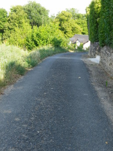
Trail Type: Short distance circuit; tarmac or hard-packed, well maintained, fairly well-marked, but a map will help. (Free brochure/maps available from regional tourist offices.)
Length: total: 6.5 kilometers or 8 kilometers/ 4 miles or 5 miles
Convenient to: Tours, France
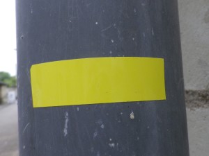
Marking: Yellow lines, straight or bent to indicate direction
Trail Description:
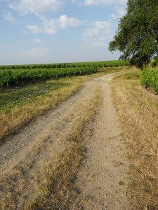
This short, easy hike covers town and vineyard in good detail, providing an intimate look at a small town within the Vouvray appellation. About two-thirds of the hike is through vineyards.
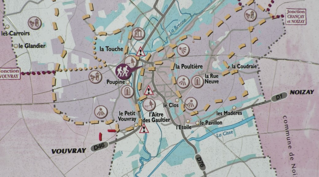
Trailhead: Vernou sur Brenne: Place (or Rue) Saint Vincent (near the “Mairie”)
Parking Possibilities: Vernou: Place Saint Vincent, a large parking lot
Public Transportation Options:
Bus: Line 54 of the Fil Bleu, the public transport system for Tours and greater Tours, serves Vernou (and Vouvray). www.filbleu.fr
Suggested Stages: Not applicable
Trail Itinerary-Reference Points:
Vernou: From trailhead (parking lot), cross Rue Aristide Briand to embankment; follow the grass path along the top of the embankment; R. du Coteau de la Poultiere, small path, R. de la Reveillerie; Vineyards, past the vine-covered ruins of a vintner hut; R. Neuve; La Coudraie (a small housing area); La Folliere vineyard; Vernou: R. du Haut Clos, R. du Coteau de la Poultiere, R. de la Bourdinerie, Place Saint Vincent
Representative Trail Photos:
Restrooms: None observed
Attractions on or near Trail:
Wine Education Trail: This trail has about a dozen wine education boards (in French only)
Church of the Holy Trinity: Church originally founded in the fifth century, and reconstructed in the twelfth and thirteenth centuries. Its Romanesque façade is exquisitely detailed.
Tasting along the Trail: None observed
Alternative Options:
Walking: A path heading south through the vineyards (well before the ruined vintner hut) will cut some distance off this trail. See the brochure for details.
Running: This entire trail is suitable for running.
Biking: The Balade en Vignes, a short 25 kilometer trail starting and ending in Tours, covers much of the western part of the Vouvray appellation area, but not Vernou.
Car: The Route Touristique des Vignobles (Tourist Wine Route), aka: Route du Vin du Loire, runs through this town, and others in this appellation, and through many other towns and villages in other, nearby appellations.
Additional Information:
Regional: http://www.touraineloirevalley.com/
Trail (segment) specific: http://www.touraineloirevalley.com/rando-velo-canoe/randonnees-pedestres/randonnees-et-balades-en-touraine (See Circuit #9)
Comments:
Distance discrepancies due to different official source materials.