Trail Name: Durch die Reben des Oelberg (Through Oelberg Vineyards)
Trail Type: A short distance circuit; well-maintained, but with varying surfaces, from grass to tarmac, marking on the trail is generic, but good throughout.
Length:
Total – 6.8 kilometers/ 4.25 miles
Convenient to: Waldshut-Tiengen, Germany; Schaffhausen, Switzerland
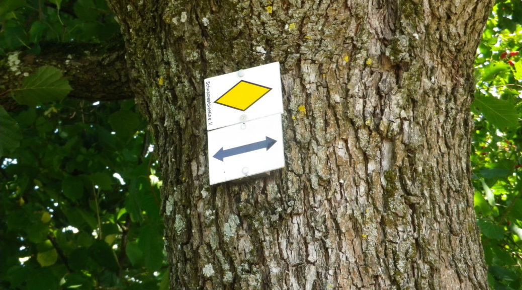
Marking:
Yellow diamond (See featured photo, and comment section below.)
Trail Description:
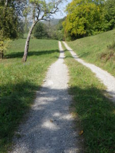
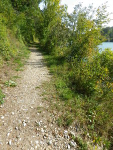
A pleasant and easy circuit that surprisingly covers a variety of landscapes in its short length, from town, to riverside, to fields, woods and vineyards, of course. The riverside stretch, about 2.75 kilometers, is beautiful and peaceful, and is the easiest part of the circuit.
Trailhead: Hohentengen am Hochrhein, Kirchstr
Parking:
Hohentengen: Hauptstrasse x Schlossweg, a medium sized parking lot; Bergstrasse, another medium sized parking lot
Public Transportation Options:
Rail: the Zurcher Verkehrsverbund operates commuter rail S41, to Kaiserstuhl, from Waldshut, Germany, to Winterthur (near Zurich), Switzerland.
Bus: The Suedbadenbus company connects Hohentengen with Waldshut-Tiengen, a larger and more central town in this area.
Suggested Stages: Not applicable
Trail Itinerary-Reference Points: (Counterclockwise)
Hohentengen: Kirchstr, Hansengelstr, vineyards above Weingut Engelhof, L161/Rheintalstr, Guggenmuehle, past Gaststube Wasserstelz, along the Rhine toward the bridge (extra: cross into Switzerland to visit Kaiserstuhl), Schlossweg, regain the river path, Badstr, Hauptstr
Representative Trail Photos:
Restrooms: None observed
Attractions on or near Trail:
Just lots of pretty scenery, and deer.
Tasting along the Trail:
Weingut Englehof, and the Gaststube Wasserstelz both offer local wines.
Alternative Options:
Hiking: The High Rhine High Way (Hochrhein Hoehenweg), a 125-kilometer-long hiking route connecting Basel, Switzerland, with Schaffhausen Switzerland, but passing mainly through Germany, albeit not through Hohentengen center itself.
Biking: The Rhine Cycle Route (aka Euro-Velo 15), over 1200 kilometers along the Rhine, is a very popular, and very well described/documented online. Alternatively, there is the Via Rhenana, a 190-kilometer bike trail in Switzerland mostly following the High Rhine, which begins in Kreuzlingen (adjoining Konstanz), and ends in Basel, passing by this small district of Baden wine, but also covering the Swiss wine areas of Thurgau, Aargau, and Baselerland, where the High Rhine becomes the Upper Rhine, a stone throw from Baden’s Markgraefler wine district.
Additional Information:
Regional: https://www.schwarzwald-tourismus.info/schwarzwald/Regionen-im-Schwarzwald/Hochrhein
Trail specific: https://www.wanderservice-schwarzwald.de/de/tour/wanderungen/durch-die-reben-des-oelbergs-zur-ruine-weisswasserstelz/18308514/
Comments:
The Schwarzwaldverein yellow diamond indicates a local trail, and is usually accompanied by destination names. In this case, from Hohentengen center, follow the yellow diamond to Guggenmuehle, as indicated in the itinerary above.
Detour across the Rhine, to the Swiss village of Kaiserstuhl, only 150 meters off the trail.