Trail Name: Rosheim – Rosenwiller (AKA: Circuit du Vignoble/Vineyard Tour)
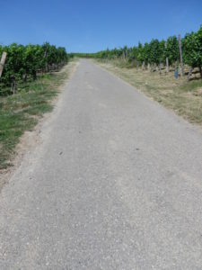
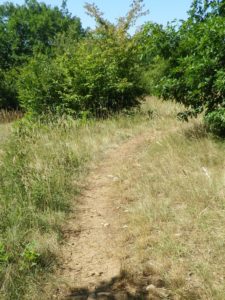
Trail Type: Short-distance; well-maintained and with mostly wide paths, either paved or hard-packed earth, with very good marking on the trail
Length:
Total – 8.7 kilometers/5.5 miles
Convenient to:
Strasbourg, France
Marking:
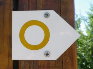
Yellow circle on a white background
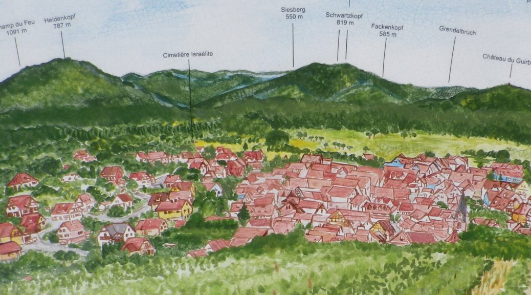
Trail Description: A gentle trail, part of which incorporates some of Rosenwiller’s short and informative education trail “De Collines en Vignobles” (From Hills to Vineyards), this trail passes through mostly vineyards and the two villages. While there is some shade, the exertion factor is minimal, with the inclines gentle enough for even families with elementary aged school children.
Trailhead:
Rosheim: R. General de Gaulle/D35
Rosenwiller: Rue de Wisch
Parking:
Rosenwiller: Rte de Rosheim x R. du Vignoble, by the cemetery; R. du Wisch, by the sports field;
Rosheim: Avenue Clemenceau, R. du Neuland 19, Parking du Neuland; both large, improved lots
Public Transportation Options:
Rail: Rosheim is served about hourly by rail from Strasbourg. Check the TER line on the SNCF (Societe Nationale des Chemins de Fer) website for details.
Suggested Stages:
Not applicable
Trail Itinerary-Reference Points: (Counterclockwise)
Rosheim: R. General de Gaulle/D35, R. du Lion, R. Braun, R. de Molsheim; through vineyards on Molshengass, left turn uphill to bench and marker at/on Fuerstweg; Rosenwiller: Through scrubland to Localities Kreuzweg, then Lindenrain, R. Belle Vue, R. de l’Ecole, R. Principale, R. de Grendelbruch, Jewish cemetery, R. du Wisch, Chemin du Reispfad; Through vineyards and orchards to Loc Papierenberg; Rosheim: Chemin/R. de la Burck, R. des Voges, R. de la Chapelle (or alt: past cemetery on Ave Clemenceau), R. General de Gaulle/D35;
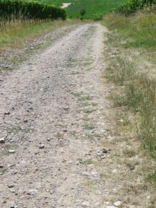
Representative Trail Photos:
Restrooms:
Rosheim: R. General de Gaulle/D35, next to the Mairie (Town Hall); Avenue Clemenceau, by the parking lot (bus area) (a pay toilet; reasonable price, but takes only a 50-cent coin!)
Attractions on or near Trail:
The nature education trail “De Collines en Vignobles” (From Hills to Vineyards)
Tasting along the Trail:
Two or three wineries each in Rosenwiller and Rosheim.
Alternative Options:
Hiking: The eight-kilometer circuit trail Parcours du Vigneron explores the vineyards and ridgeline south of Rosheim, and the area of Bischenberg.
Biking: Part of the Veloroute du Vignoble d’Alsace, a 135-kilometer-long cycling itinerary passes along this circuit from the vineyards on Molshengass to R. de General de Gaulle, then continues out of town for points south. See the Nutshell on the northern half of this route here.
Car: The Route des Vins d’Alsace (Alsatian Wine Route) passes through Rosheim, on its 170-kilometer run from Marlenheim to Thann.
Additional Information:
Regional: http://www.mso-tourisme.com/
Trail specific: https://www.outdooractive.com/de/route/wanderung/elsass/rosheim-elsass/105201389/#dm=1
Comments:
A nice trail, great for Spring, early Summer, or Fall.