Trail Names:
Circuit Cremant
Auto-Pedestre 1
Trail Types: 2 short distance circuits;
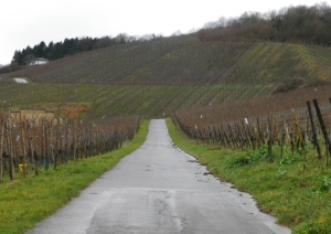
Cremant: Short hiking circuit; paved, well maintained and marked.
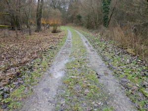
Auto-Pedestre 1: Short hiking circuit, some parts paved, some hard-packed, some soft dirt; some sections marked, but markings missing in a couple of crucial spots.
Lengths:
Cremant: 4.6 km/2.8 miles
Auto-Pedestre 1: 8 km/5 miles
Convenient to:
Luxembourg, Luxembourg, with local public transportation
Trier, Germany, with a car
Markings:
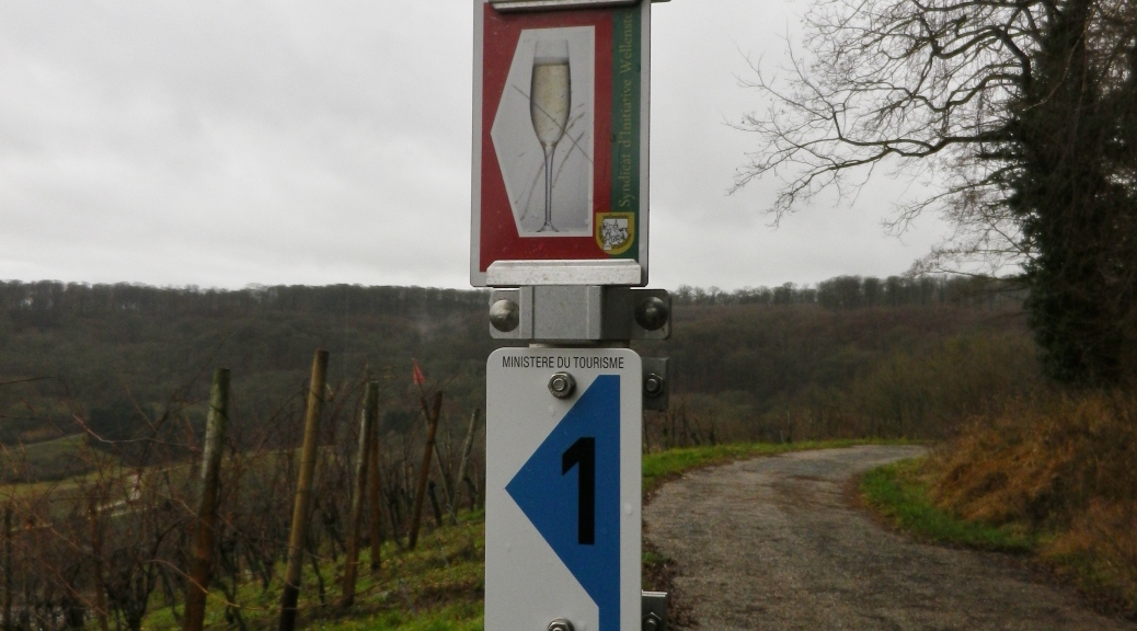
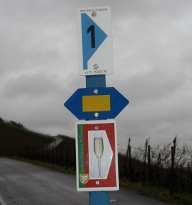
Cremant: Flute on a white pentagon, on red background with green edge
Auto-Pedestre 1: Black “1” on a blue triangle on white rectangular sign
(Note: The photo’s blue hexagon with a yellow rectangle is the sign for the Sentier de la Moselle, described below.)
Trail Descriptions:
Cremant: A pleasant walk through the vineyards above the village, paved, and stairs in two places. Some steep sections as the trail ascends, and on the descent down the vintner stairway. Virtually no shade along this trail.
Auto-Pedestre 1: The trail covers a variety of landscapes, from vineyard to forest, to nature area, hills and deep dales. Views onto the river and the interior. It is quiet and very remote-feeling in places. The trail can become quite muddy in the woods.
Trailheads:
Cremant: Wellenstein, Rue de l’Eglise, side of church/Wellenstein, Rue de l’Eglise
Auto-Pedestre 1: Wellenstein, Rue de l’Eglise, side of church/Wellenstein, Rue de l’Eglise
Parking Possibilities:
Wellenstein:
Some spots along Route de Remich/CR 151 (on lower end)
Intersection of CR 151 and N16 (at Pointe de Vue), several spots, no restrictions noted
Public Transportation Options: None noted specifically along the route, although there is at least 1 bus stop in Wellenstein.
Suggested Stages: Not applicable
Trail Itinerary-Reference Points:
Cremant: Church, Caves Cooperatives des Vignerons Wellenstein, Stairs, Pseudo-Roman temple hut, entranceway into ground, N16, Pointe de Vue, Vintner stairway, Vineyards, Rue de la Chapelle, Church
Auto-Pedestre 1: Church, Borgeck (street), explanation board in vineyard, treeline, Kuebendaellchen nature area, CR151, Vintner stairway (see Cremant trail above), Route de Mondorf, Church
Representative Trail Photos:
Restrooms:
Wellenstein, not more than 40 yards from map at start point, off the Heenegaessel (alleyway)
Attractions on or near Trail:
Pseudo-Roman temple: site of a Roman burial with explanation boards in French and German (inside), outside there is a swing for two with a great view of several Luxembourg villages, the Moselle, and Germany.
Look-out point high above the village and vineyards.
Kuebendaellchen nature area, with explanation boards on the local ecology and environment.
Tasting along the Trail: Vinotheque, Caves Cooperatives des Vignerons Wellenstein, (parking and restrooms on site)
Alternative Options:
Nordic Walking/Running: Circuit Viticulturel (short (5km) or long version (10 km)), includes villages of Bech-Kleinmacher and Schwebsange; fair number of inclines; almost exclusively a paved surface throughout. This trail follows part of the southern section of Auto-Pedestre 1.
Hiking: Sentier de la Moselle, a 55 kilometer-long route following within sight of the Moselle through most of its passage along Luxembourg’s border from Schengen near the French border to Wasserbillig at the German border.
Biking: Dedicated bike path along the Moselle covers approximately 37 kilometers/22 miles.
Car: Route de Vin (covering the towns and vineyards along the Luxembourg side of the Moselle)
Additional Information:
Regional: http://www.schengen.lu/fr-FR/mobilite-dans-la-commune/circuits-autopedestres
Trail (segment) specific:
Cremant/A-P 1: http://www.schengen.lu/fr-FR/mobilite-dans-la-commune/Circuit%20Crémant.pdf?FileID=autres%2fcircuit%2520cr%c3%a9mant.pdf
Comments:
As noted in the intineraries, the two trails begin near the church, and meet again at the vintner stairway, thus providing two opportunities to lengthen your hiking experience. Best option if doing both is to begin the Auto-Pedestre 1 trail, at the church, out on Borgeck, then picking up the Cremant Trail near the vintner stairs, or church, and following it ultimately back to the church.
In any case, follow the direction of the blue triangle, since going the reverse way on the Auto-Pedestre 1 trail is difficult because of insufficient signage outside the village. The signage for the cremant trail is sufficient to follow either way.