Trail Names: Burgunderweg and Trollingerweg
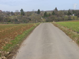
Trail Type: Short distance hiking circuits laid out by the Felsengartenkellerei (FGK) winery; almost exclusively paved, well maintained, and mostly well marked.
Length:
Burgunderweg total: 5.5 km/3.5 miles
Trollingerweg total: 8.5 km/5.25 miles
Convenient to: Stuttgart, Wuerttemberg, Germany
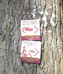
Marking: Red colored lizard and trail name written on square signs with white background with the word “Felsengartenkellerei” written on the edge.
Trail Descriptions:
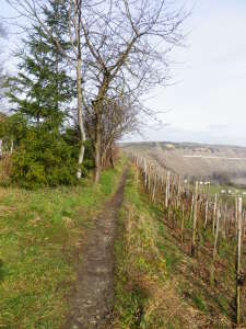
Burgunderweg: This trail begins at the FGK winery, passes near Besen (wine taverns), and has marvelous views of the Neckar River and surrounding countryside from atop the heights. Climbs are easy and much of the rest of this trail is relatively level. A stretch leading past the cemetery in upper Hessigheim is narrow, can be muddy, and not for people with balance issues. Shady sections are virtually non-existent, so best done in cool or overcast weather.
Trollingerweg: This trail begins at the FGK winery, and traverses the very scenic town of Besigheim, a real half-day treat with all its sights and hostelries. A steady but long climb along vineyards to start, but then much of the rest of this trail is relatively level, except for the modest incline into upper Besigheim. From Besigheim back to FGK, the trail follows flat lands along the river. Only a few shady spots along the trail, so best done in cool or overcast weather.
Trailheads:
Both trails’ official start – FGK winery, Am Felsengarten, Hessigheim
Trollingerweg alternatives – Besigheim: At the parking lot at intersection Hauptstr/Auf dem Kies (B27); Or at the Freibad (outdoor community pool), on Jahnstrasse.
Parking Possibilities:
Both Trails: parking lot near FGK winery, Am Felsengarten, Hessigheim
Trollingerweg alternatives: Besigheim: beyond the Freibad (outdoor community pool), on Jahnstrasse; parking lot at Intersection Hauptstr/Auf dem Kies (B27)
Public Transportation Options: Rail to Besigheim; Bus to FGK
Suggested Stages: Not applicable
Trail Itinerary-Reference Points:
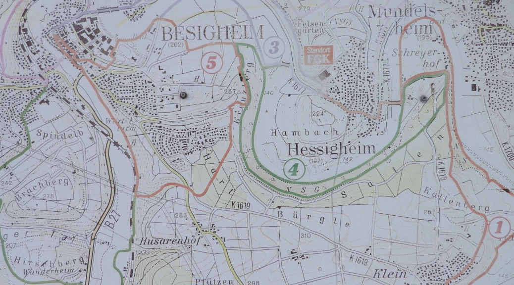
Burgunderweg: Hessigheim: FGK, Besigheimerstr, Rathausstr, church, school, past a cemetery, Kaesberg Kanzel (lookout with views of one of the Neckar River loops), vineyards; 3 vintner huts on a bend in the trail; cross Ottmarsheimerstr-Im Fetzer/Heckselplatz, fields and vineyards; Am Felsengarten (a little-used street below the Felsengarten cliffs) leading down to FGK.
Trollingerweg: Hessigheim: FGK, Am Felsengarten (a little-used street below the Felsengarten cliffs); L1115; Besigheim: Hessigheimerstr, Neckar Bridge, Stadthalle/Alte Kelter, Schochenturm (Tower and gate), Jahnstr; Freibad; ASV Hut, fish ponds, pedestrian bridge over the Neckar leading to FGK.
Representative Trail Photos:
Restrooms:
Both trails: In Hessigheim: Felsengartenkellerei – not a public restroom, but assumes you enter to try wine or make purchases
Trollingerweg: In Besigheim: Underground (pay) parking garage, at Stadthalle/Alte Kelter, on Hauptstrasse; also at Intersection Hauptstr/Auf dem Kies (B27) (adjacent to the parking lot mentioned above)
Attractions on or near Trail:
Both trails: Felsengartenkellerei
Trollingerweg: Besigheim: City walls and towers, half-timbered town hall and buildings around it, Alte Kelter wine shop, views and self-guided walks through town.
Tasting along the Trail:
Both Trails: FGK in Hessigheim
Trollingerweg: Besigheim has several eateries with good wine lists, in addition to the Alte Kelter wine shop.
Alternative Options:
Walking: These two trails, and others, overlap in places, thus can be hiked for as long (or as short) a distance as you would like.
Running: The Trollingerweg is well-suited for running.
Biking: Part (or all!) of the FGK Vom Neckar zum Neckar or the 7 Keltern Radrundweg (circuits) (See an example of the 7 Keltern signage in the Marking paragraph above.)
Car: Wuerttembergische Weinstrasse covers some of this ground, and more.
Additional Information:
Regional: http://www.3b-tourismus.de/
Trail specific: http://www.felsengartenkellerei.de/fgk/5service.html
Comments:
Both trails follow Am Felsengarten, the little-used street below the Felsengarten cliffs. The top of this street is the point where I joined the Trollingerweg from the Burgunderweg.
Burgunderweg is particularly suited for a quiet hike through countryside, with magnificent vistas across the region.
Trollingerweg is well-suited for those wanting to add a bit of sight-seeing and some decent dining to their itinerary.