Name: Breisgauer Weinweg
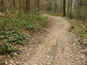
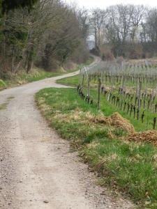
Trail type: Long distance, multi-day trail; mostly hard-packed gravel or paved in built up areas and some vineyards, well maintained and well-marked.
Length: 99.1 km/61.5 miles
Convenient to: Freiburg, Germany
Marking: Green grapes on red diamond on white background
Trail Description: This trail offers a delightfully peaceful and restorative hike through overwhelmingly rural areas. It mostly proceeds through a combination of dark forests, old orchards, pastures and fields, and vineyards covering the foothills of the Black Forest. It occasionally passes through, or skirts the outer edges of hamlets and villages, usually set in narrow valleys, before it heads over the hills again. Some of the hills can have a steep incline.
Trailheads:
Freiburg, Schwabentor (start)
Glottertal/Foehrentalstr, Wissereckstr (intermediary stop/trailhead)
Mundingen, Friedrich-Moessner-Strasse (intermediary stop/trailhead)
Nordweil, Herrenbergstr (intermediary stop/trailhead)
Ettenheim, Ausstrasse (intermediary stop/trailhead)
Lahr, Otto-Hans-Strasse (intermediary stop/trailhead)
Diersburg, Rathaus (stop)
Parking Possibilities:
Freiburg: no free parking observed. Freiburg has parking challenges, even with its many pay parking garages.
Glottertal: parking lot off Mattenmuehlestrasse, near shopping/business park area
Buchholz: Along the tracks, just east of the train stop, on In der Bannweid
Ettenheim: long-term parking lot near the cemetery (Friedhof), off Kirchhalde
Lahr: parking lots near Terrassenbad (pool), off Bergstrasse and Weinbergstrasse
Diersburg: Some parking on street near Rathaus and church, and by the sports field
Public Transportation Options:
Bus: Required for Heuwiller, Glottertal, Windenreute, Nordweil, Schmieheim and Diersburg. Two of the major bus companies serving the region are: SBG (Suedbaden Bus, GmbH) and RVF (Regio-Verkehrsverbund Freiburg)
Rail:
Deutsche Bahn has convenient connections to Freiburg, a major hub for the southern Black Forest area.
Breisgau S-Bahn (BSB) otherwise serves stops not much more than a couple of kilometers from the trail as well, the most northern one on the trail being Buchholz.
Suggested Stages Official:
Freiburg – Glottertal (Foehrental Kreuz) (15.5 km/9.6 miles)
Glottertal – Mundingen (21 km/13 miles)
Mundingen – Nordweil (15.1 km/9.3 miles)
Nordweil – Ettenheim (12.5 km/7.5 miles)
Ettenheim – Lahr (18.5 km/11.5 miles)
Lahr – Diersburg (16.5 km/10.25 miles)
Suggested Stages (Mine (approximate distances)):
Freiburg – Buchholz (21 km/13 miles)
Buchholz – Malterdingen (22 km/13.7 miles)
Malterdingen – Ettenheim (20 km/12.5 miles)
Ettenheim – Lahr (center) (19 km/11.8 miles)
Lahr (center) – Diersburg (17 km/10.5 miles)
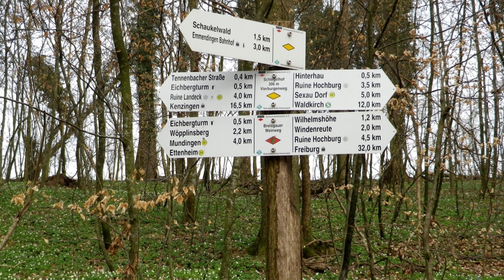
Reference Points on Trail Itinerary:
Freiburg: Kanonenplatz, 7 Linden and circular hut with stone columns, Panoramahotel; Wildtal; Heuweiler; Unterglotteral; the “Rebhaeusle”; Buchholz (near train station); Reichenbaechle; Sexauer Raebhisli (Rebhaeusle), Burgstell, Muehlebaechle; Hochburg: castle ruins and hamlet; Windenreute: cemetery, Bergstr-Wannenweg-Schlegelhof; Eichberg and Eichbergturm (observation tower); Woepplinsberg; Mundingen: Moenchshofstr-Friedrich Moesner str; Voegelisberg; Blumberg; Statue of St Gallus’ bear; Schutzenhaus Malterdingen (firing range/club); Malterdingen Dorfbach; Bombach: Breizgenstr-Karlstr-Im Weingarten; Nordweil: Hochwaldstr-Herrenbergstr-Im Herrenberg; Bleichheim: Fohreneckstr-Bleichtalstr-Steinbrunngasse, small chapel; Broggingen: Dragonerstr-Riedstr; Golf course; Small chapel, Kahlenberg, Gaststaette Heuberg and observation tower; Ettenheim: Im Pfaffenbach-Rohanstr-Austr-Muehlenweg; Wallburg: Ortstr-Hinterdorfstr-Weinbergstr; Schmieheim: Sportplatzstr-Schlossstr-Dorfstr; Klotzwald; Eichbergkreuz; Lahr: Heutalweg-Otto Hahn Str-Altmuehlgasse-Altestr-Weinbergstr, Terrassenbad (outdoor pool); Lierbachhof; Friesenheim: Lahrgasse, past cemetery, Im Weiertsfeld, Weinbergsr; Oberschopfheim: Lahrstr-Meiersmattstr; Riedmuehle; Diersburg: Bachstr, along creek, Kreisstr and Rathaus.
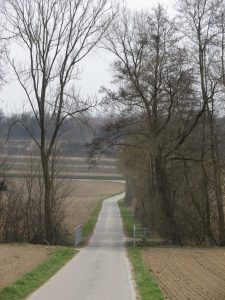
Representative Trail Photos:
Restrooms:
Freiburg: Salzstrasse (intersection with Universitaetstr) by the Uniseum building; Gerberau, by the Augustiner Museum.
Malterdingen: Cemetery, on Leimtalweg (almost a kilometer off the trail)
Ettenheim: On the front side of the Rohan palace, off Rohanstrasse
Diersburg: None observed
Attractions (along the trail):
Freiburg: Munster, main church; charming squares and narrow streets in old town; Art and history museums
Ettenheim: Baroque town center
Lahr: Old town center, and a colorful Chrysanthemum Festival in late October-early November
Tasting along the Trail:
Taverns/informal restaurants are found in quiet corners along this trail, and all offer local wines. Seasonal hours.
Alternative options:
Walking:
-Any segment by itself
-Short (3- 9 km) Wine Learning Circuit trails partly follow this trail in the villages of Buchholz, Koendringen, and in the hills outside Ettenheim and Herbolzheim.
Running: Completely suitable throughout, except for a couple of narrow, steep and uneven short segments (rare, but there are some rough spots). Best sections for sure-footing would be from Kanonenplatz, Freiburg to Panoramahotel, and Mundingen to Malterdingen (Schutzenhaus).
Biking: Freiburg to Glottertal, Malterdingen (Schutzenhaus) to Reichenbaechle, and Lahr to Diersburg, are cyclable, with hybrids or mountainbikes. (In other places, the trails are possibly too rough, narrow and steep for some bikes or bikers.)
Car: Parts of this trail are on the Badische Weinstrasse.
Additional information:
Regional: http://www.schwarzwald-tourismus.info/
Trail (segment) specific: http://www.schwarzwald-tourismus.info/Media/Touren/Breisgauer-Weinweg
Comments:
Plan ahead! The trail link above leads to an excellent website dedicated to providing detailed information about this trail and help for planning your trip along it.
Once outside Freiburg, the next town of any size on the trail is Ettenheim, then Lahr, respectively about 60 and 80 kilometers distant. The seemingly remote, small villages can present some logistical challenges. See above.
Starting this trail using public transportation is easy, as Freiburg is a major hub for the area. While rail transport is available in towns heading north, these are not convenient to the trail. (A hike of over 3 kilometers is required in places to go from station to trail.) Freiburg’s easy-to-use metro-rail system extends north to Buchholz, which is why I made Buchholz my first stop. However from there to Ettenheim, a combination of buses must be used to reach the trail or possibly lodging.
My stages are longer than the official ones. Hence only a 5-day itinerary vice the official 6-day one. (I never seem to have enough time….) I also chose the intermediary stops to ensure proximity to rail hubs, and to ensure multiple lodging options.