Trail Name: Anello del Verdiso
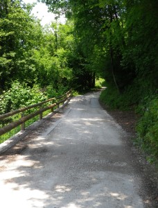
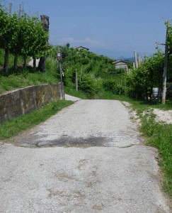
Trail Type: Short distance; very diverse surfaces (asphalt, cart trail, dirt), somewhat maintained; the route itself is marked fairly well.
Length: total: 8 kilometers/5 miles
Convenient to: Valdobbiadene, Treviso Province, Veneto Region, Italy
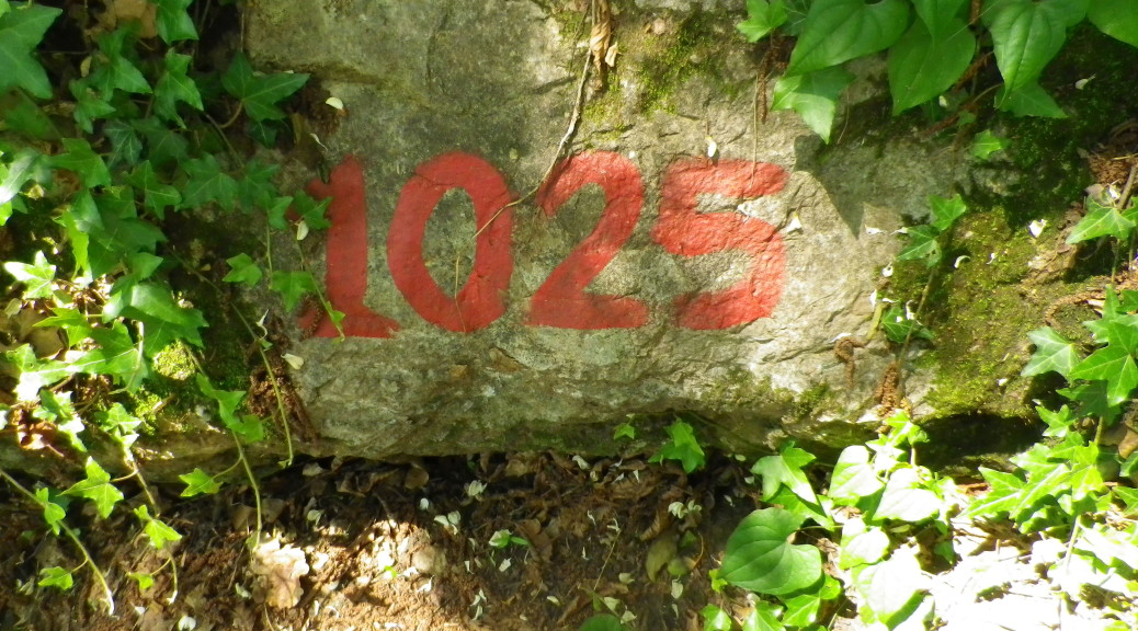
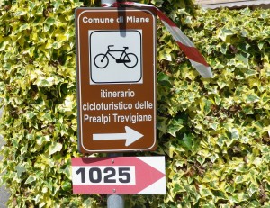
Marking: Signs bearing the number “1025”, (or red and white horizontal bars)
Trail Description: This was a great trail to experience a variety of landscapes, and hiking challenges. Far from tourist crowds, in a mountainous and forested territory that attracts cyclists and hikers, it was a peaceful and well-laid out trail. It varied from a quiet village to forests (lots of shade) to vineyards; from very easy to more challenging. Its short distance makes it ideal for families with tweens or young teens.
Trailhead: Combai, Vecchia per Miane
Parking: Combai; large parking lot on S36/Via Trento, east of the village center
Public Transportation Options:
Bus: Mobilita di Marca (MOM) Company links the series of villages running from Valdobiadene through Combai, Miane, Follina and Cison, to Vittorio Veneto (served by rail); See Bus 121.
Suggested Stages: Not Applicable
Trail Itinerary-Reference Points:
Combai: Vecchia per Miane (just after the 2.5 story electric cabin by the town fountain), downhill through woods and vineyards; Follow the red and white markings and 1025 signs to Via Crodoi, Via Calchera, Localita Calchera; Vineyards, (Val da Ross); Grass path uphill, Nocciolo signboard, toward il Duel (vineyard); Past street sign: Via Ronch, Civico 43; Heights with great view by old vine-covered house; Le Tenade vineyards; Into woods on very narrow trail, make a 180 degree turn to go past an old refuge with trail marking; Continue along a narrow trail in the woods; Pass above S. Micele delle Serre church (looks like two houses); Vineyards (of Serre); Follow the Itinerario Cicloturistico Prealpi Trevigiani signs to the wooden cross (della Pedena) and wooden fox sculpture, then a pig sculpture in the woods; Follow the red and white markings and 1025 signs to leave the woods, and climb into vineyards; Follow the red and white markings and 1025 signs to a picnic table in the Coste vineyards; Via Miramonte-Via Capovilla to the village center.
Representative Trail Photos:
Restrooms: None observed
Attractions on or near Trail:
Great views. In the distance to the east two local sites are visible: The Abbey of Santa Maria di Follina, a Cistercian Cloister and Church dating back to the Eleventh Century; and Castelbrando, an impressive castle of earlier lords, now a hotel and restaurant. About 15 minutes by car in the opposite direction, is the town of Valdobbiadene, with its quaint historic center, and several wineries in town.
Tasting along the Trail: None observed
Alternative Options:
Running: Most of this trail is suitable for running as most of the trail is hard surfaced, although there is a section high above Combai that would be too narrow to run along.
Biking: Part of this trail follows a cycling trail called the Itinerario cicloturistico delle Prealpi Trevigiane.
Car: Strada del Prosecco passes through Combai, and Miane as well as other towns in this area, notably Valdobbiadene and Follina
Additional Information:
Regional: http://www.marcadoc.com/tourist-information-treviso/
Trail (segment) specific: http://www.comunedimiane.it/turismo_desc.asp?id_cat=2&id=29
Comments:
Follow the itinerary heading clockwise from/around the village. Otherwise the trail markings won’t be as clear or evident.
A half kilometer-long section of this trail is narrow (not much wider than a boot width), and requires a good sense of balance and lack of fear of heights.