Trail Name: Anello del Gallo Nero (AKA: Vino e Architettura)
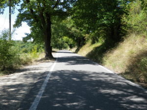
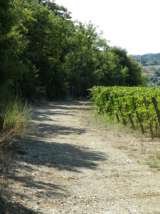
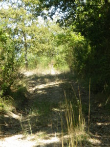
Trail Type: Medium distance hiking circuit; almost exclusively gravel, or uneven surface, not maintained, and not marked.
Length: total: 13 kilometers/ 8 miles
Convenient to: Castellina in Chianti, Italy
Marking: None!
Trail Description: A hike cross-country through unspoiled Tuscan countryside, this trail encompasses untamed woodlands, vineyards, and scrubland, passing the occasional farm house/winery/agriturismo, and except for Fonterutoli, by-passing villages and hamlets altogether. Mostly moderate inclines along the way afford panoramic views as far away as Siena and San Gimignano.
Trailhead:
Fonterutoli: by the Church, at the intersection V. Giacomo Puccini x V. Giuseppe Verdi
Parking Possibilities:
Fonterutoli: Church, Piazza Giorgio la Pira
Public Transportation Options:
Bus: See the Toscana Mobilita “Tiemme” website (http://www.tiemmespa.it/ ) for details on buses to Fonterutoli.
Suggested Stages: Not Applicable
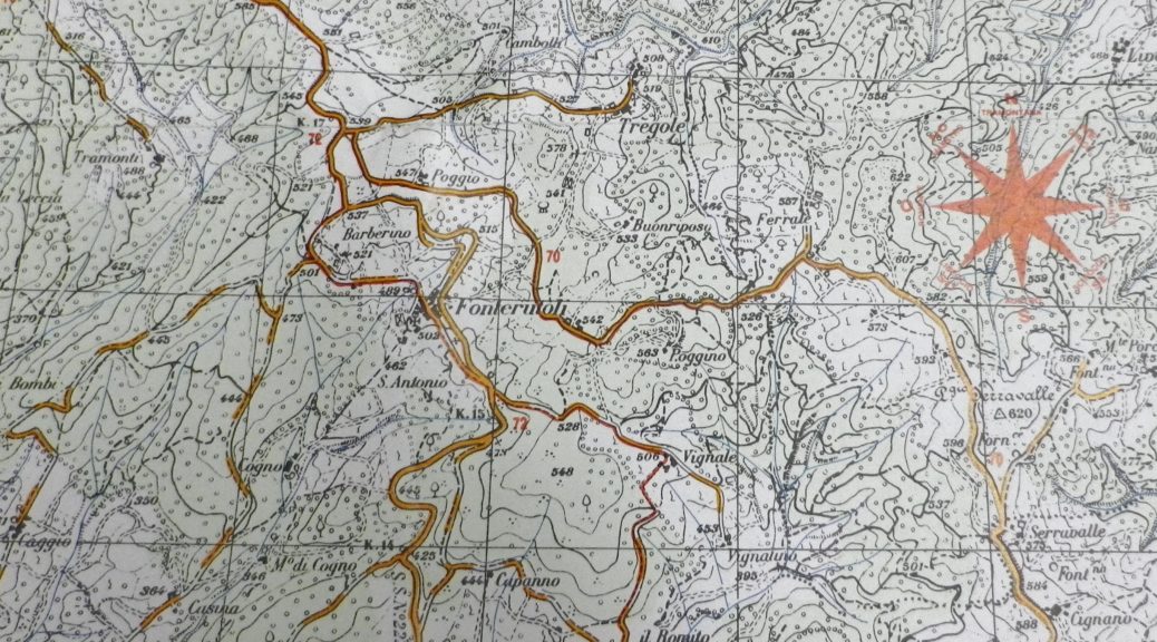
Trail Itinerary-Reference Points:
Fonterutoli: V. Giuseppe Verdi, Cross SR222, heading southeast; Localita Vignale: (hamlet and street name), hiking sign Via Romea, right at the farm house; Woods, past the hamlet of Capanno; Casafrassi Hotel Agriturismo, woods, vineyard with building; Quercegrossa (outskirts): Circle past Agriturismo Mulino di Quercegrossa (large pools); Str di Selvolini (past le Gallozzole); Topina (outskirts): Cross SP 119 le Badesse, Str delle Messe, (keeping the hilltop hamlet of Topina on your left), Str Campalli, (sign Farm Campalli), circle left past the farmhouse toward Cogno, through woods; Fork Right at blue sign for Cogno; Turn right at Brown sign for Caggiolo toward Fonterutoli
Representative Trail Photos:
Restrooms: None Observed
Attractions on or near Trail:
Fonterutoli
Etruscan Ruins Along Strada di Vagliagli
Castello di Fonterutoli cellars and tastings
Tasting along the Trail:
Fonterutoli: Castello di Fonterutoli
Casafrassi winery
Alternative Options:
Car: Strada del Vino e dell’Olio Chianti Classico, covers this area and more
Additional Information:
Trail (segment) specific: http://www.caivaldarnosuperiore.it/ppp/ (Anello del Gallo Nero)
Comments:
While the tourism office in Castellina does have a hard-copy map of the trail, be advised that it is not detailed enough to use for the hike!
Be aware when researching online: There are a couple of trails in this area called the Gallo Nero; this one did not go to Lomano!
This trail is also known as Vino e Architettura, and the gpsies.com website has downloadable gpx coordinates (as of September 2016). Thanks!
Thanks as well to CAI (Club Alpino Italiano), the Italian mountaineering club, for the online map and information about this trail.
Maybe someday there will be signs, or at least official gpx coordinates to download, that will make this trail, which has such great potential, more accessible to others.
See last year’s Tuscan hike here: Villa Vignamaggio: Trails in a Nutshell