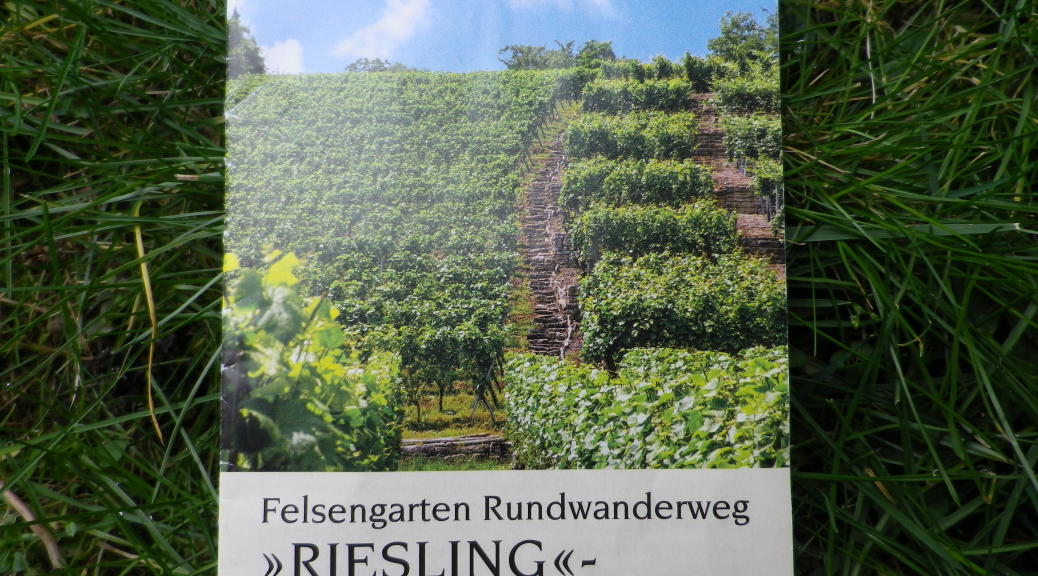
Trail Name: Felsengartenkellerei (FGK) Riesling Wanderweg (aka: Riesling Rundwanderweg)
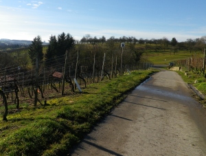
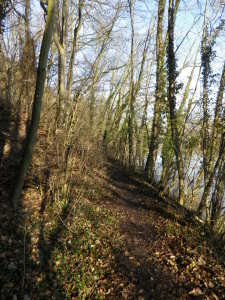
Trail Type: mid-distance hiking circuit; paved in villages, and most vineyards, some hard-packed gravel, but also some dirt paths as well; trail itself is not particularly well maintained, but is marked in most places.
Length:
Longer route: circa 16 km/10 miles
Shorter route: 12.5 km/7.75 miles
Convenient to: Stuttgart, Baden-Wuerttemberg, Germany
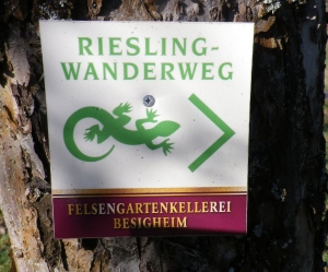
Marking: Green-colored gecko and trail name on a white background with “Felsengartenkellerei” written beneath.
Trail Description: This trail has variety as it wanders along the Neckar River, through fields, orchards, forest and dramatic, cliff-side vineyards. It also passes through 3 little villages. Suitable for the adventurous – rough going in spots: steep, narrow, and dirt path sections that can turn to mud.
Trailhead: Hessigheim: Felsengartenkellerei
Parking Possibilities:
Hessigheim: Felsengartenkellerei, large lot just beyond visitor parking for the cellar.
Schreyerhof: a small parking area just beyond the gasthaus parking lot on K1618.
Public Transportation Options: None terribly convenient to hiking this circuit, although do-able with rail to Besigheim, then using local buses to join the trail in Hessigheim, or Grossingersheim.
Suggested Stages: Not applicable
Trail Itinerary-Reference Points:
Hessigheim: Felsengartenkellerei, village center, Neckar bridge, along the river; Schreyerhof; Nature Preserve; Kleiningersheim: Talstrasse (past Muehle), fields and vineyards; Ingersheim (aka Grossingersheim): Talstrasse-Schneckenbergstr-Andreas Kieser-Strasse; Vineyards, rest area by palace; Kleiningersheim: Kirchplatz-Austr; wooded area; Schreyerhof (street, restaurant and hamlet all of the same name); Neckar Bridge, Hessigheim: Felsengartenkellerei
Representative Trail Photos:
Restrooms: Hessigheim: Felsengartenkellerei
Attractions on or near Trail:
Nature Preserve
Felsengartenkellerei, winery and gift shop
Tasting along the Trail:
Hessigheim: Felsengartenkellerei
Alternative Options:
Walking: To shorten this hike, follow the shorter of the two routes mapped for the Riesling Wanderweg (i.e.: begin the return leg of this hike at Kleiningersheim).
Running: Middle segment of this circuit (through the nature preserve) would be slow to run, due to the often muddy and/or uneven surfaces.
Biking: This trail is not for bikes as bikes are prohibited in the Nature Preserve. Instead, follow a 25 kilometer circuit, the FGK Radrundweg (Bike circuit) called “Vom Neckar zum Neckar,” which covers some of the same territory as this hiking trail, and more.
Car: The Wuerttembergische Weinstrasse covers this territory, and more.
Additional Information:
Regional: http://www.3b-tourismus.de/
Trail (segment) specific: For a brochure on the Riesling Wanderweg, to include a map, visit http://www.felsengartenkellerei.de/fgk/5service.html
Comments:
Trail maps and signage are at variance by Kleiningersheim. One brochure and a trail sign shows the trail climbing the (178) steps at Kleiningersheim, then returning to Schreyerhof. Another brochure shows the trail continuing past the steps at Kleiningersheim, reaching Grossingersheim about 2 kilometers distant, before returning to Kleiningersheim, where it joins the shorter trail near the stairs. Once you know this anomaly, it is possible to follow either trail with just a map and the signs without confusion.
This circuit cuts in on itself by Schreyerhof, so an even shorter circuit would be possible: Schreyerhof-Kleiningersheim (or further to Grossingersheim)-Schreyerhof.