Trail Name: Wuerttemberger Weinradweg
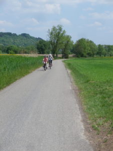
Trail Type: Long distance; well-maintained and almost exclusively paved, marking on the trail very good
Length:
Total – 354 kilometers/219 miles
My segment – 32 kilometers/ 20 miles
Convenient to: Stuttgart, Tuebingen, Rottenburg am Neckar, Germany
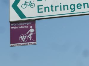
Marking: Square metal shield with a white-outlined stylized rider on a bicycle superimposed on a burgundy background
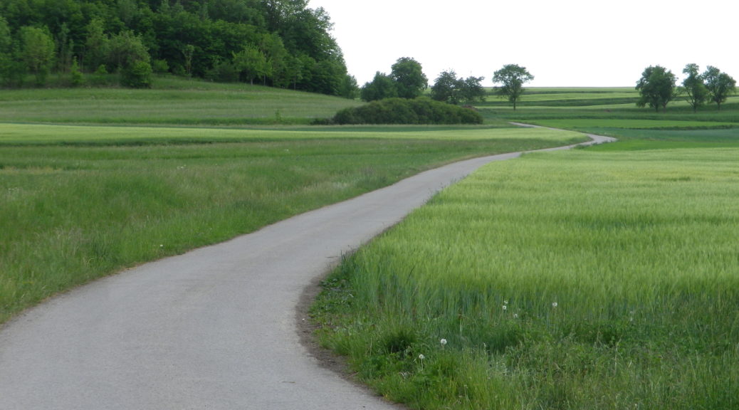
Trail Description: (My segment only) Starting in a town on the Neckar River, this trail quickly becomes a gently hilly cycling route through bucolic fields, pastures and copses in the hinterlands of Tuebingen, Germany, returning to the Neckar via the Ammerbach valley.
Trailhead:
Rottenburg am Neckar: Marktplatz
Parking:
Rottenburg am Neckar: Jahnstrasse, (Festhalle), Ulmenweg
Tubingen: Haagtor on Schleifmuehleweg; Gerstenmuehlstr
If doing a circuit: Breitenholz: Friesenweg (P Breitenholz, a “Wander Parkplatz” (parking area for hikers))
Public Transportation Options:
Rail: Deutsche Bahn regional and local trains connect Tuebingen and Rottenburg with Stuttgart, a major train hub in southern Germany. Local trains (R73) run from Tuebingen cover the Ammer valley to Herrenberg, stopping at the villages of Unterjesingen, Pfaeffingen, Ammerbuch/Entringen and Altingen.
Bus: The Verkehrsverbund Neckar-Alb-Donau (www.naldo.de) bus lines cover this area.
Suggested Stages:
Trail Itinerary-Reference Points: (My segment only) (Clockwise)
Rottenburg am Neckar: Marktplatz, Seebronner Str, Jahnstr, Bike Path; Wurmlingen: Almenstr, Bricciusstr, Weidestr, Bike Path; Wendelsheim: Kelterstr, Obere Dorfstr, Bike Path; Oberndorf: Rottenburger Str-Poltringer Str, Engwiesenstr, Bike Path; Poltringen: Ehringer Str, Aiblestr, Blasenbergstr, Entringerstr, Bike Path; Bike path Along Schulsteige, Along woods, past Modelflugplatz to B28; Breitenholz: Brunnaeckerstr-Raiffeisenstr-Walterstrasse, then Bike Path along Walterstrasse, Ammerbuch-Entringen: Friedenstr, briefly along B28, Zeppellinstr-Karlstr, Poltringer Weg, Bike Path through fields; Pfaeffingen: Eisenbahnstr-Nagolderstr, Bith Path; Unterjesingen: Bike Path along B28, Untere Str, Rottenburger Str, Tuebingen: Bike Path, Sindelfingerstr, Schleifmuehleweg, Tunnel, Alleenbruecke, Uhlandstr (joining the Neckartal Radweg)
Representative Trail Photo:
Restrooms:
Rottenburg: Marktplatz (behind the Rathaus); Weggentalstr x Seebronnstr, in the Bus parking lot
Tuebingen: Haagtorplatz; Marktplatz (Rathaus), Europastr (opposite the AOK office)
Attractions on or near Trail:
Unterjesingen: Kirchhalde, Keltermuseum (open seasonally), with collections pertaining to regional daily life and winemaking.
Tuebingen, with a rich medieval and renaissance past, and Rottenburg, with its Roman past, have many non-viticultural attractions worth a visit. There are also punting trips along the Neckar, with wine tasting opportunities if booked in advance. See the first regional link (Punting Trips) under “Additional Information” below.
Tasting along the Trail:
See the two last sentences above.
Alternative Options:
Car: The Wuerttemberger Weinstrasse, 496 kilometers of wine exploration, starts in Metzingen, approximately 25 kilometers/15.5 miles northeast of Tuebingen. See the second regional link below.
Additional Information:
Regional:
https://tuebingen-info.de/index.php?id=727
https://www.weinwege-wuerttemberg.de/wuerttemberger-weinstrasse/route-details/?#dm=1
Trail specific: https://regio.outdooractive.com/oar-tmbw-rrpl-bw/de/tour/fernradweg/wuerttemberger-weinradweg/5515903/
Comments:
Great for a leisurely, summer day trip, with opportunities to explore Tuebingen and Rottenburg.