Trail Name: Weinrunde Malans-Jenins or Rundweg Malans
Trail Type: Medium distance; almost exclusively paved, well maintained, and very well-marked.
Length: 10.4 km/ 6 miles
Convenient to: Chur, and Bad Ragaz, Switzerland; Vaduz, Liechtenstein
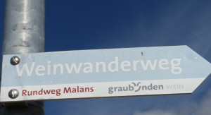
Marking: Rectangular blue and white arrows with white lettering: Weinwanderweg” (and sometimes red lettering “Rundweg Malans”) (See comment below)
Trail Description:
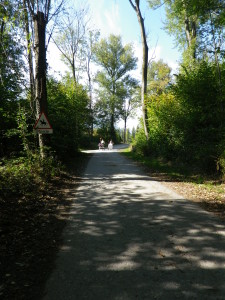
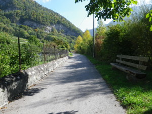
This easy, baby carriage-accessible trail follows through village streets, wood paths, vineyards and fields, with modest inclines, and gentle descents. It is a quiet trail, crossing several streams, and affording stunning views of distant Alps and dramatic rock peaks and cliffs.
Trailhead: Malans, Bahnhof
Parking Possibilities:
Malans:
-Unterdorfstrasse (near the train station; not free, but very reasonable rates if paying with Swiss coins)
-Wolfgasse (off Jeninerstr)
Jenins: Gassa (lot off the street between the two creeks)
Public Transportation Options:
Bus: Post Auto 22 (Bad Ragaz-Maienfeld-Jenins-Malans-Landquart)
Rail: The “Rhaetische Bahn” serves Malans from Chur, Landquart and Davos.
Suggested Stages: Not applicable
Trail Itinerary-Reference Points: (Counterclockwise)
Malans: Bahnhofstr-Ruefegasse-Muehlegasse, cross stream, path to Praettigauerstr-Tobelgasse-Nuttgasse-Schermengasse-Scadenaweg-Degenstr (Cable car station)-along a wooded path following Jeninerstr-Gassa; Jenins: Gassa-Pramalinis-Hinterwaldweg, Underdorfstr-Jeninserstr, vineyards, Wiesenstr, around ponds, Unterer Selfenenweg; Baguggiweg-Unterdorfstr
Representative Trail Photos:
Restrooms: None observed
Attractions on or near Trail: Just lots of stunning and peaceful scenery.
Tasting along the Trail:
Malans: A small restaurant (Balans) serving local wine is next to the train station
Jenins: Has four small restaurants right on the trail, and several wineries open at various times
Alternative Options:
Running: This entire trail is suitable for running
Biking: The Rhein Route, Stage 3, from Chur to Buchs (near Vaduz), covers the area between Malans and Jenins (albeit at lower elevations), and more.
Inline Skating: Rhein Skate follows part of the lower section of this trail from Landquart to Maienfeld.
Additional Information:
Regional: http://en.graubuenden.ch/ (look for the Chur/Rheintal area)
Trail (segment) specific: http://www.graubuenden.ch/news/2015/08/kulinarik/weinwanderweg-graubuenden-943.html (Klick on the .pdf link below the German description)
Comments:
This circuit forms part of the Graubuenden region’s longer distance Weinwanderweg Graubuenden (also known as Weinwanderweg Buendner Rheintal) trail, that starts in Chur and ends about 30 kilometers (18 miles) later near Vaduz. On the signs therefore, you see both “Weinwanderweg” (for the long trail) and sometimes “Rundweg Malans” in red (for the circuit).
Tip: This trail passes the Aelplibahn cable car entrance. If I had only known…I would have begun the hike provisioned with food and a local wine, taken the cable car to the top of the mountains, had a picnic lunch on the high Alpine slopes overlooking the Rhine and distant peaks, (or tasted a wine on the small pub’s viewing deck), then come back down to finish the trail.