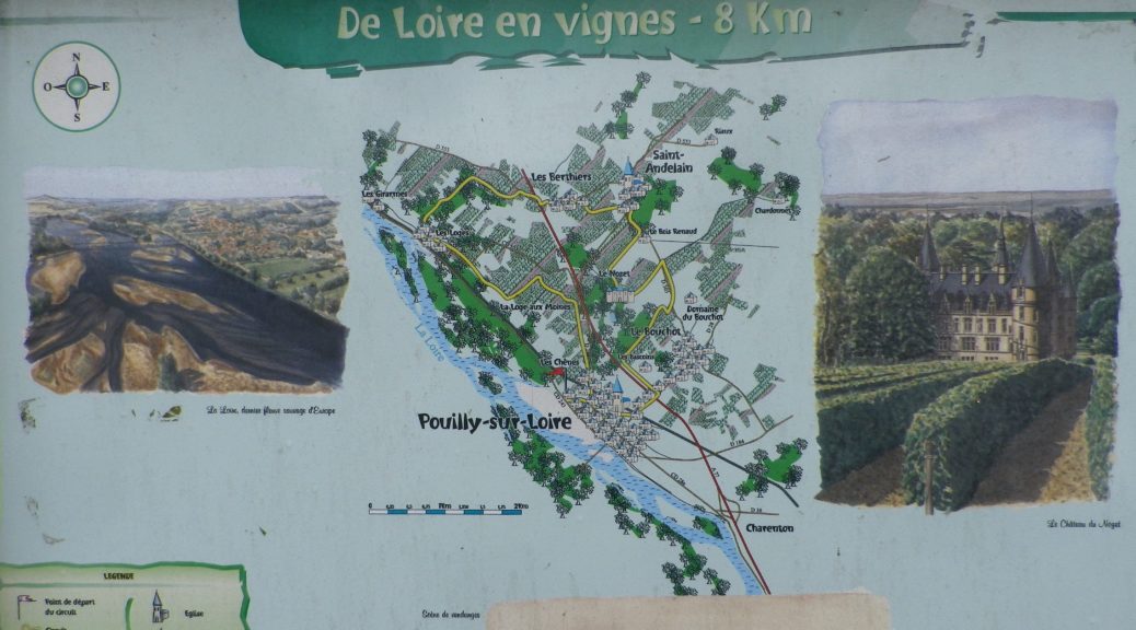
Trail Name: De Loire en Vignes;
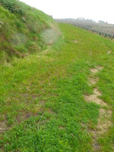
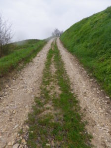
Trail Type: A medium distance circuit; varied surfaces, from grassy, or rough, to asphalted road; marking is spotty on the trail.
Length: Total – 12.84 kilometers/ 8 miles
Convenient to: Nevers or Sancerre, France
Marking: A combination of trail specific (yellow grapes on a white background, yellow directional marking, and nothing.)
Trail Description:
This trail really highlights the terroir that is Pouilly-Fume, as it passes close to the river, over hills, and through the vineyards that make up this appellation, while providing lots of vineyard views, along with some river views, the occasional education board, and bits of interesting architecture here and there.
Trailhead:
Pouilly-sur-Loire, Rue Waldeck-Rousseau
Parking: (Pouilly-sur-Loire)
-Rue des Ecoles, a large, unimproved lot in the center of town.
-Rue de la Place, a medium-sized area, with improved parking spots by the church; a busy, much used lot.
Public Transportation Options:
Train: SNCF has regional train service to Pouilly from Nevers
Bus: No serviced bus stops were observed.
Suggested Stages: Not applicable
Trail Itinerary-Reference Points: (Counterclockwise)
Pouilly-sur-Loire: R de la Gare, (Tour du Pouilly Fume) R. Waldeck-Rousseau-R de Paris, Chemin des Foltieres, Voie Romaine, vineyards; Les Loges: D 153/R St Vincent, R des Pressoirs; to D553A (continue southeast), underpass (A77); Les Bertiers: Champs des Plantes, D553B; St Andelain: D153, D503; Le Nozet: Chemin de Nozaret (circle De Ladoucette winery and castle counterclockwise) right onto D 503 Chemin des Cotes en Verses; follow along A77, right on D28/R Gousse-Ave Laubespin
Representative Trail Photos:
Restrooms: None observed anywhere!
Attractions on or near Trail: None observed
Tasting along the Trail:
Both Pouilly and Les Loges had a few cellars either on or very close to the trail, that sold directly to the public during normal business hours.
Alternative Options:
Biking: La Loire a Velo (Eurovelo 6) covers this area and more. It is an 800 kilometer trail that routes cyclists along the river, through or detouring to some of the famous towns and chateaux of the area, as well as past the famous vineyards of Pouilly-sur-Loire, as well as Sancerre. (As an added bonus, the section between Sancerre and Pouilly is mostly bike trail, vice roadway.)
Car: Coteaux de Pouilly-Sancerre is a 43-kilometer car route in and around the territory of these two neighboring appellations.
Additional Information:
Regional: http://www.pouillysurloire.fr/
Trail specific: http://www.ffrandonnee.fr/idees-rando/rando.aspx?id=1885
Comments:
Only a very small section of shade is available throughout the length of this hike.
Definitely need a good map or GPX for this hike, although due to far distant line of sight, it would be difficult to get lost in most places.
Although the official trail map by the church in Pouilly-sur-Loire indicates the trail is 8 kilometers, it is really 12.84 kilometers per the GPX trace, confirmed by online comments from other hikers.