Trail Name: Bernkastel-Kues to Traben-Trarbach
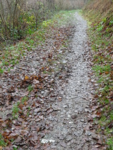
Trail Type: Short distance trail; much of it paved, some of it grassy, the rest is dirt trail; well maintained, but the markings are not exclusive to this route, and change in places.
Length: total: 6.5 kilometers/ 4 miles
Convenient to: Koblenz or Trier, Germany
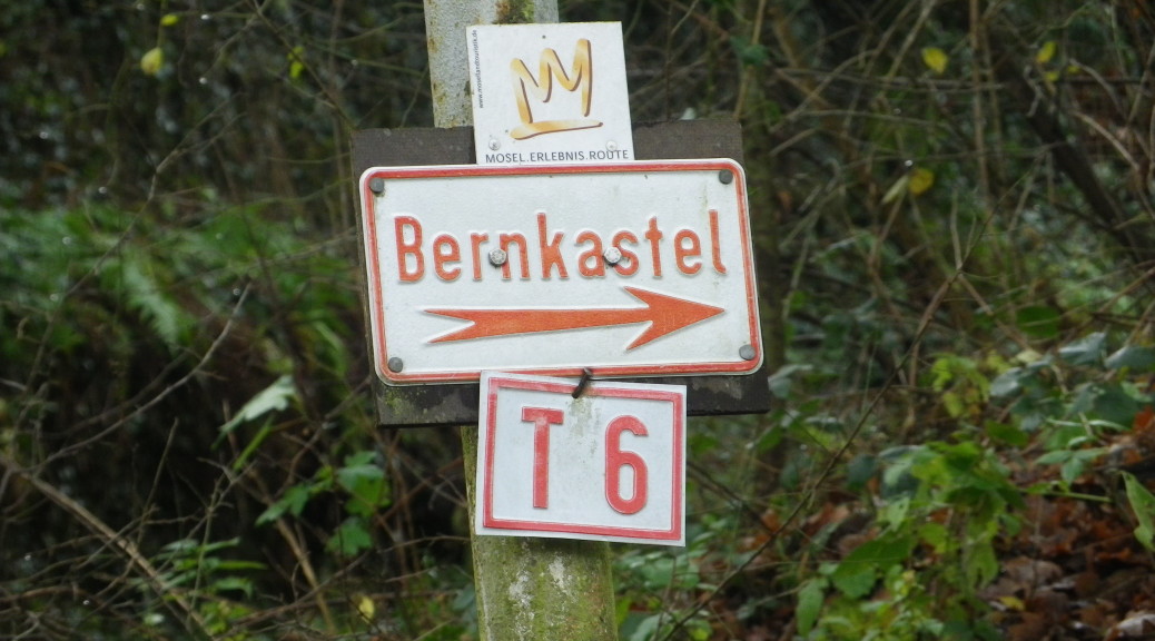
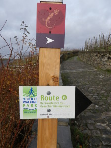
Marking: Multiple signs indicate the direction to “Traben-Trarbach” (or “Bernkastel” if going the opposite way); Gold lizards on a red heart on a red square marked this trail the first part of the way; Once atop the hill, “T-6” and “Mosel Erlebnis Route”, were also signs on this same trail all the way to Trarbach. (See the featured photograph above, and red sign in the first photo below.)
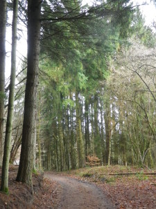
Trail Description: A trail which proceeds immediately uphill through vineyards on paved roads, offers great views of the Moselle Valley. It continues through woods to the top of the ridge above Bernkastel and Graach, and is all downhill to Trarbach, where the terrain becomes urban again.
Trailheads:
Bernkastel: Graacher Weg
Trarbach: Grabenstrasse
Parking:
Bernkastel: Off B53, along the Moselle.
Trarbach: Off B53 x Moselstrasse, along the Moselle.
Public Transportation Options:
Bus: Bernkastel-Kues, Traben-Trarbach, and other villages in the area are served by buses from the Verkehrsverbund Region Trier (VRT Trier) company.
Rail: Deutsche Bahn trains serve Traben-Trarbach (Traben side) from Koblenz downriver, and Trier upriver.
Ferry: Return to Berkastel using the Gebr. Kolb Passenger Ship Service. (It also continues upriver to Trier.) Find details at http://www.moselrundfahrten.de/en/bernkastel/home.
Suggested Stages:
Not applicable
Trail Itinerary-Reference Points:
Bernkastel: Grabenstr-Graacherstr-Graacher Tor-Alter-Graacher Weg; Bernkasteler Badstube vineyards; Sankt Josef Chapel; Zur Eisernen Weinkarte; Kaisergarten; Traben: woods, large old drystone wall; Bernkasteler Weg-Wildbadstr-Weiherstr-Mittelstr-Am Markt-Grabenstr-Moselle River
Representative Trail Photos:
Restrooms:
Bernkastel: Off Moselstrasse, in the square behind the Tourist Information Office
Trarbach: Mosellestrasse, under the Mittelmosel Museum
Attractions on or near Trail:
Trarbach-Trarbach:
Mittelmosel Museum: provides an overview of the history of the area, with geological, archeological, as well as plastic and fine arts exhibits.
Grevenburg Ruins, literally, of the site of the former lords of the area.
Interpretive trail on the site of the Mont Royal fortress, built by the famous Vauban, under Louis XIV
Architectural Variety: from Medieval to Jungendstil (for which this town is particularly famous)
Bernkastel-Kues:
Mosel Weinmuseum: fantastic multi-media education about viniculture and viticulture in this district, with a wine tasting area.
Medieval architecture here is well-preserved, and several small squares very inviting.
Tasting along the Trail:
The Eisernen Weinkarte Tavern is directly on the trail. Additionally, taverns and wine shops (to include the Weinmuseum) offering tastings for a reasonable fee, may be found in both towns.
Alternative Options:
Walking: Lizards Love Riesling, Bernkastel’s Wine Education Trail (see red sign above); an easy, short (3.7 kilometers/2.3 miles) circuit designed with 11 explanation panels (also in English). About half of the panels are also on the trail to Trarbach.
Running: Entire trail can be run.
Additional Information:
Regional: http://www.bernkastel.de/startseite.html
Trail (segment) specific: http://www.bernkastel.de/mosel-erleben/wandern-im-moselurlaub/weitere-wandertipps/bernkastel-nach-trarbach.html
Comments:
A major roadway construction project is underway at the summit. Signs have been moved in places (to include the Eiserne Weinkarte), and the way to T-6 can be torn up and a morass of mud for about 80 yards/meters. Continue straight, keeping to the grass while heading downhill, and it improves shortly thereafter.