Trail Name: Balade Romaine dans les Vignes
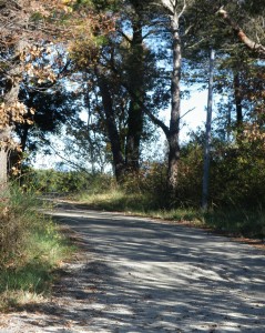
Trail Type: Short distance circuit; exclusively paved, well maintained, but the route itself is only marked generically.
Length: 7.3 kilometers/4.5 miles
Convenient to: Orange, Vaucluse Department, Provence Region, France
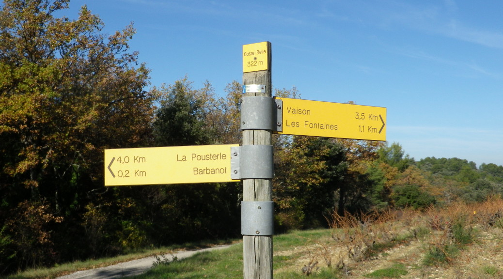
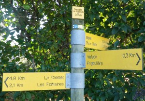
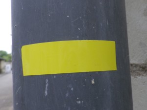
Marking: Yellow signposts and yellow rectangles
Trail Description: A gentle, very family-friendly circuit, walking through countryside outside Vaison-la-Romaine, with very slight inclines and declines once beyond the upper town.
Trailhead:
Official: Vaison-la-Romaine, Roman bridge, through upper town
Alternate: Vaison-la-Romaine, Chemin de Barbanot parking area
Parking:
Vaison-la-Romaine (Upper town): Chemin de Barbanot, a small lot after the aqueduct arches (up high on left)
Vaison-la-Romaine (Lower town): Avenue Cesar Geoffray, just upstream of the Roman bridge, a large lot along the river.
Public Transportation Options:
Rail: None in Vaison
Bus: None convenient to the trail. However, Vaison is served by buses from two large towns: Bollene and Orange (with its amazing Roman theater). Check the www.pacamobilite.fr site.
Suggested Stages: Not Applicable
Trail Itinerary-Reference Points: (Clockwise)
Vaison-la-Romaine: Upper town, Rue de l’Eveche, Chemin de Barbanot x Chemin des Fontaines (at Derriere le Chateau signpost, the first signpost on the trail), orientation table, tarmacked Chemin des Fontaines; Les Fontaines (name on signpost) at Chemin des Fontaines x Chemin des Bois Communaux, Coste Belle (name on signpost), (follow signs for Vaison – Derriere le Chateau, (not Vaison – Les Fontaines)), Chemin de Barbanot, (closes circuit at Derriere le Chateau signpost) meander through upper Vaison, head down to bridge.
Representative Trail Photo:
Restrooms: Montee du Lavoir (Upper town)
Attractions on or near Trail:
The upper town provides a look at medieval Vaison, with charming, narrow winding streets, old dwellings, and the castle.
Lower Vaison has 2 excavation sites of large areas of the former Gallo-Roman town, a great opportunity to see what life in this town was like from the first to the fifth centuries A.D.
The Roman bridge (the official start point) still carries traffic over the Ouveze River!
Tasting along the Trail:
Several bars, cafes, and restaurants in upper and lower town, and a few wine shops in the lower town
Alternative Options:
Running: This entire trail may be run easily.
Biking: This circuit (once at the Chemin des Fontaines x Chemin de Barbanot intersection) is ideal to bike with children as young as six.
Car: Vaison-la-Romaine (but not areas on this trail) is on the Route des Vins des Cotes du Rhone
Additional Information:
Regional: http://www.vaison-la-romaine.com/spip.php?rubrique209 (in French only)
Trail (segment) specific: http://www.provenceguide.com/itineraires-touristiques/vaison-la-romaine/randonnee-pedestre—balade-romaine-dans-les-vignes/provence-ITIPAC084CDT0000052-1.html
Comments:
Signposts indicate the direction to the next named site/location on your selected trail. Therefore, you need to know the names of the locations on your trail, which are often named fields or meadows, hilltops, crossroads… (See the itinerary, or a detailed topographic map.) In lieu of the signposts, painted yellow rectangles on trees, rocks, posts, the ground… indicate that at least you are on a trail (vice off a trail and on someone’s property). See the photos above.