Trail Name: Vignoble et Chateaux
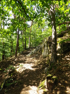
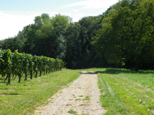
Trail Type: Mid-distance circuit; varied surface types (paved, grass, dirt, rock), with some steps to climb; fairly well-maintained trail; the route itself is usually clearly marked, except in a couple of places.
Length: Total: 10.5 kilometers/6.5 miles
Convenient to: Colmar, France
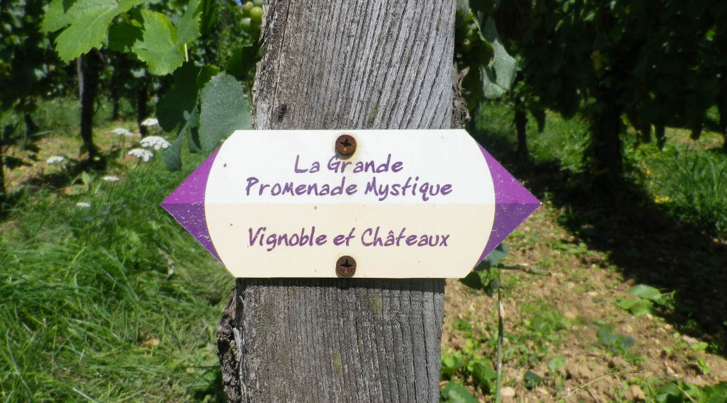
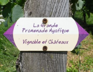
Marking: Trail name “Vignoble et Chateaux” in purple letters on white background. (Another trail name also appears on these signs when trails overlap.)
Trail Description: A delightful circuit hike through varied terrains, from flat to steep, through fields and still forests, villages and vineyards, the high point – literally and figuratively speaking – being three castle ruins overlooking the Rhine River valley.
Trailhead: France, Alsace, Haut-Rhin, Eguisheim, tourist office
Parking Possibilities:
Eguisheim:
Place Charles de Gaulle: either in front of or behind the school, several spaces, but weekends only in some spots.
Grande Rue (before Rue de Muscat): large lot
Route des 5 Chateaux: large lot below the castles (Road begins in nearby Wintzenheim or Husseren)
Voegtlinshoffen: between the traffic circle on D1, and the road to the Abbaye de Marbach, you will see a couple of small parking areas
Public Transportation Options:
Bus: Line 208, from Colmar Train Station or the Champ de Mars, to Eguisheim, then Husseren or Voegtlinshoffen; and return.
Suggested Stages: Not applicable
Trail Itinerary-Reference Points:
Eguisheim: Grande Rue, Rue Porte Haute, vineyards, forest; Trois Chateaux (3 Castles); Hussaren: Forest, cross a road, picnic area, old quarry site; Voegtlinshoffen: past Abbaye de Marbach, pass by the northern end of Rue des Trois Chateaux, cross road D1/Route du Vin north of the traffic circle, vineyards; Eguisheim: Rue des Trois Chateaux
Representative Trail Photos:
Restrooms:
Eguisheim:
Grand Rue, behind the Tourist office (nominal cost)
Place Charles de Gaulle by the fountain.
Attractions on or near Trail:
Eguisheim Center: A true medieval gem, and voted one of the prettiest villages in France.
Three Castles: Evocative ruins; great spot for picnics and photo ops.
Tasting along the Trail:
Just follow the signs in Eguisheim!
Alternative Options:
Walking: Sentier Viticole (Viticultural Discovery Trail), only 3 km, passes through Eguisheim’s Grand Cru vineyards.
Running: The trail is not suitable for running up to the castle.
Biking: Paysage a Bicyclette, Par le Vignoble, 31 km/19.25 miles, likewise begins in Eguisheim, and covers some of the flatter areas of the featured trail, and more.
Car: Eguisheim is on the Route des Vins d’Alsace, over 170 km/105 miles long.
Additional Information:
Regional: http://www.ot-rouffach.com/237002663.html
Trail (segment) specific: http://www.ame-du-vignoble.eu/index.php/en/
Comments:
Pay attention to the wording on the trail signs! This trail is one of several local thematic trails that crisscross the area, and each other. All have very similar signs, varying only with the words on the sign. See the photo above, which shows two names: the Vignoble et Chateaux and the Grande Promenade Mystique, where they both happen to share a segment of a path.
Leaving Eguisheim, the trail markings are great. Once on the incline in the woods, if in doubt, continue to follow signs for the castles (up, and up again, on a narrow track, vice the broad path or dirt road). From the castle parking lot, the markings are good, until just outside the Marbach Abbey, where my GPX coordinates diverged from the trail markings. In any event, just outside Voegtlinshoffen, across D1 and in the vineyards heading toward Eguisheim, the trail markings become prominent once again.
Some people will find the trail section from the tree-line to the castle challenging both aerobically and strengthwise.